I've been "eyeing" up this Forum Test Thread since it started.
Unfortunately, I'm a daily lurker that posts very little if at all. And, I purchased an AntiFog pair of glasses from Ryders directly off their website in August 2015. However, I think their newer frames might solve some of the issues I'm having with the current frames I have.
Also I know that I'm late to the party with my response. Oh well, the worse you can tell me is I don't make the cut so here goes…
1. What eyewear do you currently use when you ride (goggles, glasses) and for what kind of riding?
I wear Ryders Thorn AntiFog photo-chromatic yellow lens frames for pedal riding and Oakley Airbrake goggles for park riding.
2. Have you had any experience with Ryders eyewear?
Yes. I Enjoy the fit of the Thorn frame so much that after I bought the AntiFog pair I bought the polarised sunny lens pair for everyday use off the bike.
3. Are fogged up glasses a problem for you when riding?
YES! A HUGE PROBLEM!!!!!
4. Where do you live and ride?
Whistler is home and I ride everywhere from Squamish to Pemberton. I also do regular Fall trips South of the borer to Washington state and further.
5. "Mini" Review of the Lezyne Super GPS
Here's an update initial review of a gps cycling computer that I just posted to an MTBR forum. It is definitely more than 300 words but I feel that it represents what I can contribute to this forum of testers if I am allowed the chance.
….
Here's an update after 2 and half weeks of riding with the Super GPS.
Think of this as an initial impression.
I've had 11 rides; 3 of which I tracked separately with the Super GPS and my S6 phone using Strava.
Tracking Values
There are differences in some of the numbers but not so big that it concerns me. The biggest difference is with the maximum elevation and total distance. Strava always has the higher values. The biggest difference in elevation was about 80m (262ft) and between 50m to 200m (164ft - 656ft) in distance.
I know that over time the difference in distance will add up to a large difference. However, I'm not concerned. I'm not using this for training just as data collection to nerd out over.
The other difference is how the Super GPS manages stopped time versus riding time. It doesn't. However, when I upload the data to Strava then the times are separated properly.
I did try to pause the recording every time I stopped for a break or longer than a couple o minutes. But inevitably I would forget to start the unit again. It also caused me to add lap splits because I would forget to long press to pause the recording sometimes. After trying to remember to pause and restart the unit on a couple of rides I'll just leave it to run even when I take a break. And I'll let Strava sort it out in the wash when I upload the ride data.
On the rides that I used both my phone with Strava and the Super GPS at the same time there wasn't really any major differences in the values. They were about the same as when I used only the Super GPS and then uploaded the data to Strava.
It would seem that the differences come from how Lezyne GPS Root and Strava process the data.
Sensors - Compatability?
I am looking into getting a speed sensor but it's not a priority.
The sensor that has piqued my curiosity is the Garmin speed sensor that attaches to your bike's hub.
My two concerns are whether it will fit around my hub because I have eThirteen hubs that are huge in diameter! And, I'm unsure if the unit will connect with the Super GPS even though they both run on ANT+.
Overall I'm happy with how the Super GPS works.
Menu
Using the menu is a little challenging at times because of the amount of scrolling you need to do. Although, I haven't really needed to dive into the menu now that I have everything set up.
My biggest complaint is remembering to long press to stop my recordings. My last couple of rides I've forgotten to do that. That is more user error rather than the unit though. Still it's a pain because I'm adding a lap split to my recording even if I'm adding no extra data.
Connectivity
The connectivity to your phone is straight forward using Bluetooth. You do need to have the Ally app open on your phone for the Super GPS to connect properly. The ability to see your messages, emails and calls is cool but I don't use it. I carry my phone in my pocket so have easy access to it. Also I don't need to be reading texts while riding.
Initially the Ally app wouldn't show a detailed map once my ride was uploaded to my phone. But there has been a recent update to the app and now the map screen will load.
Lezyne website - GPS Root
The Lezyne site is easy to use. It is similar to how Strava's site is layed out. I do like the Lezyne site better because it does a better job of presenting the data in one spot.
The Lezyne GPS Root maps for my area have some of the older well established trails marked but not any of the newer trails that have popped up in the last few years. I'm not using this unit or these maps to route plan so it's not a concern to me. It's just something to note.
The terrain based map is more detailed in topography than Strava's or Google's maps which is nice. The relief and shading has more detail.
Battery
Battery life is good so far. I'm still running it off of the first charge from when I bought it. It's currently sitting at 45% after two and a half weeks and eleven rides. As well as all my fiddling with it just figuring it out.
Screen
The screen visibility is good in all light conditions that I've been riding in (sunny, in and out of trees, raining/cloudy). I don't need the use of the backlight.
I have the screen setup with the full 4 lines of data showing. I was concerned that it might too busy to be able to read at a glance but that's not the case. When I'm riding I'm really only interested in what my speed is and current ride distance are. And, when I stop for breaks I can look at more info if I like.
[ATTACH]11200[/ATTACH]
Satellite Acquisition and Signal Strength
The Super GPS is quite quick in picking up satellites from the time I turn it on. So far it has been under a minute when waiting for a satellite acquisition.
And, I've yet to have the unit drop a connection.
Under trees it seems to work well. I do notice that sometimes my actual speed is faster than what is listed on the unit when in the trees. However, when looking at the map after I've uploaded my ride the track is more or less spot on with the trails that I was riding.
I live and ride in Whistler. Which is in the Coast Mountain range of Southern BC. Lots of dense tree/forest and mountains to get in the way but as I said I haven't had any major issues with acquiring a satellite signal and keeping it for the duration of the ride.
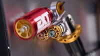
Attachment to Bike
The attachment to the bike is secure. I'm using the direct handlebar mount with the rubber bands that are provided. I picked up an extra mount for my other mountain bike so that it's easy to use the unit on both bikes.
[ATTACH]11201[/ATTACH]
[ATTACH]11202[/ATTACH]
The Super GPS does sit up a bit high on the bars. But not so much that it's seriously exposed in the event of a crash. Realistically if you're crashing in a way the the bars are upside down I think you have more to worry about than the condition of the unit!
The thing that you need to be careful about is f you turn your bike upside down for a trailside repair. On my bikes the unit does come in contact with the ground when my bikes are flipped over. The unit just touches the ground but doesn't have the weight of the bike on it. If I had my bike flipped on uneven or rocky terrain I would have to be mindful of removing the Super GPS before flipping the bike over.
[ATTACH]11203[/ATTACH]
[ATTACH]11204[/ATTACH]
In summary.
The user for the Lezyne Super GPS would be someone who is looking to collect data on their rides. And not someone who is looking for turn for turn navigation.
It is minimalist and holds a charge for multiple days. It has ease of connectivity so that you can have multiple sensors in use (although, I have yet to try that) and it is easy to upload/sync your rides through your phone using the Ally app using Bluetooth.
As I said I'm happy with how the Super GPS works. It ticked all the boxes for what I need it to do and, so far, it has been doing that.
EDIT - Sorry, I can't seem to embed my pictures.