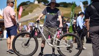
We have all joined TORCA recently.
I can't find anything on the forum…but maybe I'm not reading it properly, is there a "secret" section I'm not aware of?
PS - What's an enduro?
We have all joined TORCA recently.
I can't find anything on the forum…but maybe I'm not reading it properly, is there a "secret" section I'm not aware of?
PS - What's an enduro?
theres a trail map section on the torca homepage. not to be confused with the discussion forum.
theres a trail map section on the torca homepage. not to be confused with the discussion forum.
Indeed there is, but most of the links are dead. And certainly they are to older maps.
When I noted the forum, I meant the "discussion board": http://torca.ca/phpBB/index.php
There is a section on Trail Building, but you need to be signed on to participate.
PS - What's an enduro?
A bike specifically designed with astute care and attention to enable a mountain bicyclist to be able to go BOTH uphill and downhill with aplomb. Good times indeed.
So I know the interwebs communication can come across poorly in many ways, so I'm going to chock this up to me mis reading your responses.
Do I detect a reluctance to give up details on where to ride on Eagle Ridge? Am I missing something?
Trail peaks used to have a great trails section for Eagle Mtn, but it's under construction at the moment, so it's leaving me having to ask for advice…
Just looking for some friendly "park here", maybe "try this trail, look for this" sort of advice…
just zoom in on google maps. it'll lead the way.
Yup… you are misreading my response.
I googled and searched for a couple maps and posted the links for you. They are older, but remain a great starting point to explore Eagle.
I typically park on Panorama at Stoneridge and climb up the gaslines. This is shown on the Gutsploder Map.
There are other trails not shown on these maps, but if you explore trails like Manhandler, Massage Therapist, Mossom, and Dentist, you will criss-cross these trails, allowing you to explore them while also knowing where you are.
So, no ill intention. I think the maps are great for a first orientation. There are other folks here on the forum that know more than I do and may have mapped these for themselves, but I've found them exactly the way I'm saying to you. I think some of the trails may be appearing on the trails part of google as well, but I'm on my phone right now. Good luck!
Didn't make it up to Eagle Ridge yet - And now I'm in Romania for the week…
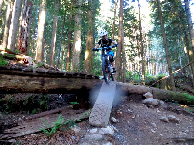
However, made it up Burke before leaving and man…the trails, even with all the rain were in good shape…We went all the way up the far spur to Six? and Slayer…Six was fantastic fun..great work on the drops and jumps whoever has built those up….trails were a bit slick, but for the rain we've had recently they were great…so much fun!
Can't wait to get up there again soon.
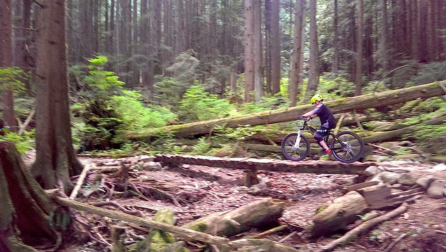
Evening ride on Burke. Didn't get there until 6:45. Man Burke is getting busy these days. Lots of people out enjoying trails in fine conditions.
Did a great loop with the kids. Parked at Switchback, rode up the road to the gate, then up to Upper Dawg and then Hustler. Then back up the road and then to Last Run/Garbage down to gate, then quick rip down road to Conifer Road and into Hustler one more time to finish.
What goes down has to first go up:

And then He said, "let there be light":

Nothing like a young Berminatrix:

Playing the game of concentration but with real consequences:

Mom being demonstrative without telling them to clean up after themselves:
Not the usual 3 wheel sizes:

Up to Eagle tonight with the boy while the girl has soccer practice.
That's awesome.
Short lap on Eagle last night was the girl was at soccer. Climbed up Nimby and then hit Blue Line. First time for both for the boy. I'd have bought him a beer if I could have. Instead, I bought him a Slurpee and had myself 2 beers.
My buddy's first ride in a couple years, so the pace was perfect.


Where abots is blue line if i may ask?
Blue Line is easy to find. When you get to the top of Imby at the powerlines, turn right for about 250m and it'll be on your right, back down the mountain. If coming up the gas right of way, turn left under the powerlines and climb about 500m or so until you see the ski road coming from the power tower to your right. It'll be on your left.
Not a long trail, but nicely built with enough challenges to keep everyone satisfied.
Short lap on Eagle last night while the girl was at soccer…
WH - I get a kick out of your posts and photos. Great use of these threads. Keep 'em coming.
Nice! I took my 9 yr old up to Overtime, then Dawg and Hustler. After a few tries in the past, he's finally got it and was stoked. Only had to get off his bike twice, the entire ride.
"Ripping Styles, Holmes!"
- Tommy Guererro, Search for Animal Chin
Bit of a surprise yesterday when we climbed up to the top of Six? Only to find that the "access" road that took you down to the lower power tower had been "covered" and made pretty much impassable. So we thought we would follow the main power line road to maybe end around to the entrance…but it's all "covered" and impassable.
We managed to climb down a steep embankment while lowering our bikes to get to the old "river bed" trail that leads to the power tower, and finally to the trail head…But wow…not sure if they are coming back to make the roads passable again, but as it stands, we will need to do some serious "maintenance" to get to that trail head…I'm not positive this is the top of six, so please reference our Strava notes here: http://app.strava.com/activities/145017321.
Deliverance, Triple crown, "other trail heads" are all still accessible as the road is fine, it's just farther West where it's now a problem. Didn't get pictures of it all as we totally forgot just trying to find the trail head…
Otherwise, the trails were in great shape, six and slayer are just such a fun combination…also discovered Overtime for the first time yesterday…Crazy that we've ridden by that trail head hundreds of times but never noticed…
Forum jump: