New posts

Southern Chilcotin (2015)

June 11, 2015, 9:09 a.m.
Posts: 6
Joined: July 29, 2012

Descent from Windy to Spruce has another 10-15 trees down, very little snow to slow you down, great dust free riding.

really? we were where up there last week from the gunn creek side and cleared all but three trees. though the last treed ridge before the true alpine was clogged in snow and we opped for the old spring trail.

We went through that last treed ridge….

June 11, 2015, 12:29 p.m.
Posts: 2009
Joined: July 19, 2003

thanks for the up date. that section is in need of a serious amount of chain saw work. there was 2-3 feet of snow there two weekends ago!

Just a speculative fiction. No cause for alarm.

June 24, 2015, 8:34 a.m.
Posts: 160
Joined: Nov. 19, 2002

camped out at the end of Relay over the past weekend…road was in okay shape, few mud pits coming out Sunday after Saturdays wet and cold weather. We did Little Paradise, Little Graveyard, Relay on Saturday in varied and challenging weather. 3 heavy snow squalls, rain, and then the sun came out and sky went bluebird for the return back down Relay. Little Graveyard is still pretty wet from seepage/snow melt, but there isn't much snow left in the alpine so I'd imagine that it will probably dry out fairly quickly over the coming weeks with the forecast hot temps and dry weather. Lots of large, carnivorous wildlife tracks in the mud which is always super rad to see, the larger than palm sized wolf tracks were a highlight for me!

drive up relay friday evening

headed up Little Graveyard Pass

the col on Little Graveyard Pass

weather got heavy…

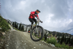
lower cinnabar shuttle laps on the way home sunday were really good and summer like!

June 24, 2015, 10:25 a.m.
Posts: 8848
Joined: Nov. 19, 2002

camped out at the end of Relay over the past weekend…road was in okay shape, few mud pits coming out Sunday after Saturdays wet and cold weather.

Did you drive down the steep hill on the end of the Relay road? It has been a couple of years since I was last up there but at time it was in poor shape. (In years past I'd driven down and back up it.)

Last time I was out there, there were deep ruts in dried mud past the steep hill section.

June 24, 2015, 10:35 a.m.
Posts: 160
Joined: Nov. 19, 2002

Did you drive down the steep hill on the end of the Relay road? It has been a couple of years since I was last up there but at time it was in poor shape. (In years past I'd driven down and back up it.)

Last time I was out there, there were deep ruts in dried mud past the steep hill section.

yup, bit loose, but we didn't have much problem with it…the off-camber exposed section before that is moderately nerve wracking, with a shovel and mattock and 15 minutes of digging though it would be pretty mellow….

June 24, 2015, 12:56 p.m.
Posts: 8256
Joined: Nov. 21, 2002

awesome, thanks for the udpate!

WTB Frequency i23 rim, 650b NEW - $40

June 24, 2015, 8:31 p.m.
Posts: 6
Joined: July 29, 2012

Rode from Tyaughton up through Paradise to Castle Pass yesterday afternoon. Paradise has some blowdown, fairly muddy. Castle Pass trail dry. We would have had a hard time on the descent to Tyaughton without the GPS, very faint. The ride out Tyaughton has a lot of blowdown, mostly dry.
Today we did a lap from the lodge up Taylor, ran in to a Grizzly lowdown on the trail just before the creek crossing, lots of noise and it bailed in to the woods. We found 2 BC Parks Rangers near the top of Eldorado, they were just finishing, having cleared all the downed trees to the Eldorado Pass. The ride down to Eldorado basin is mostly clear/dry. We dragged all the trees we could off the trail to the Tyax Eldorado Cabin, still needs some work. Great conditions otherwise. Up to Lick is good, just a couple small snow patchs. Descent has lots of downed trees, dry. Lower Lick is dusty

June 24, 2015, 8:51 p.m.
Posts: 8848
Joined: Nov. 19, 2002

Thanks for the trail update Jmay.

June 30, 2015, 11:01 a.m.
Posts: 299
Joined: June 21, 2010

Two days of riding.
Day 1 - Taylor- ridge o Rama- cinnabar. Cinnabar has some routefinding, otherwise totally clear. Bit of a walkabout to find a good route. Such an amazing ride!
Day 2 - late start - high trail to the pass, turned around back down to Molly dog and pepper. That was super great.

Cinnabar had some blowdown on the top. Great dirt, starts to get pretty dry around lower cinnabar.
Sow and Cubs in eldorado, said some hikers.

July 3, 2015, 12:46 p.m.
Posts: 8848
Joined: Nov. 19, 2002

Paradise Creek trail:

Lower portion has wet and muddy spots, that equals bugs. 11 trees removed from trail head to sub-alpine, all clear now. (The approach road from 2 lower creek crossings still has some trees down on it, easy to get across them. Watch for predators, there was a fresh deer head on the road so predators are active in the area.)

http://www.trailforks.com/trails/paradise-creek-trail-23486/

Castle Pass trail:

Still about 4 snow patches to cross near the top of the pass. Air temp during the day was warm so it is melting, but melting also means it is like trying to walk across the top of a Slurpee.

http://www.trailforks.com/trails/castle-pass-trail/

July 3, 2015, 2:16 p.m.
Posts: 160
Joined: Nov. 19, 2002

Paradise Creek trail:

http://www.trailforks.com/trails/paradise-creek-trail-23486/

last year when we were riding up the road to the start of Paradise Creek trail two of us were ahead of the group and apparently a cougar walked out of the woods and was watching us go up the road, the following group coming up behind saw it watching us until it realized there were more and took off….

July 3, 2015, 3 p.m.
Posts: 8848
Joined: Nov. 19, 2002

last year when we were riding up the road to the start of Paradise Creek trail two of us were ahead of the group and apparently a cougar walked out of the woods and was watching us go up the road, the following group coming up behind saw it watching us until it realized there were more and took off….

We grouped up and didn't hang around the deer kill zone.

The amount of predator prints in those 3 valleys is impressive.

We haven't seen a cougar up there but we have seen a bobcat/lynx a couple of times.

July 5, 2015, 7:42 a.m.
Posts: 50
Joined: Dec. 1, 2013

Love the posts. I'm heading up there soon and we're planning to ride Camel Pass. Any views on Lick Creek vs Cinnabar as a descent? Thanks.

July 5, 2015, 11:48 a.m.
Posts: 299
Joined: June 21, 2010

Cinnabar basin is a much longer ride, and cruises through much more terrain. It's harder to get to, and easy to get lost once you are there.
Once you are on the true descent, cinnabar is very long.
Lick is freaking amazing as well, blowing through all the wildflowers in the subalpine. It's a shorter ride, but still not a slouch to get to.

July 5, 2015, 8:08 p.m.
Posts: 50
Joined: Dec. 1, 2013

Cinnabar basin is a much longer ride, and cruises through much more terrain. It's harder to get to, and easy to get lost once you are there.
Once you are on the true descent, cinnabar is very long.
Lick is freaking amazing as well, blowing through all the wildflowers in the subalpine. It's a shorter ride, but still not a slouch to get to.

Thanks so much. I've gor the S. Chilcotin map + GPS so hopefully I can find where I'm going.

Forum jump: