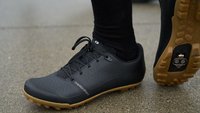
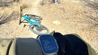
Springtime in the interior, ticks are common in high grasses. A buddy of mine in Williams Lake told me he pulled 31 ticks off him the other day! I had one on me yesterday. They go away once it gets hot. Its only a short window when you can get them on you.
Kamloops 2016
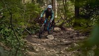
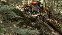
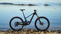
it would seem Merritt trails and conditions could be addressed here? looking at some videos i found online, wow, some of that stuff looks incredible. a bit of everything and a cross between fast buff and real gnarly stuff. some long descents. when the new 6" travel bike is ready in a couple weeks, fingers crossed, i need to get down there.
Still too early (as of April 9), losts of snow in the shadows/north facing. A lot of trees down on the ride up.
thanks eh. did the Dewdrop trail today. some snow and mud at the top but manageable. about 50% of the trail is road/double track. the single track portion is excellent.
Not sure if anyone checks this but figured id throw out an update for Iron mountain in merritt.
Been slaving hard up there with Chris Post the last few weeks and here are the mods that have been done and the trails that are good.
99- clear of blowdown and given a minor rake and big reroute at the top to avoid swamped out wet section
98-clear of blowdown and saw a few little reroutes up top but needs some brushing and weedwacking(likely doing this tomorrow so should be good soon)
revival and mid revival- pimped top to bottom
Chrispys connection- cleared, brushed and raked but needs one bridge rebuilt(still ridable just consistintely rotting away)
treats- the lap to be had if you like rock. fully clear and pimped top to bottom with a couple reroutes
choke whistle- chundery and steep but good to go
tyrant- brought back to life with a few fresh bridges and new top section, havent been down it yet but its pimped aside from a little dirt work on the new top
berms- pimped
fifi's-pimped
threeshot willow-pimped
rotary wankle- pimped but needs a bridge where it ties back onto godey
godey steeps-pimped
heroic doses/lostboys- hasnt seen any love(we will get to it)
godey- needs brush trimming
Thats essentially it for now. would do the mountain good to get some tires on it so if you know whats what go and get it while its good.
Cafe blog-www.bicyclecafe.blogspot.com !!!
Cafe site-www.bicyclecafe.com/kamloops !!!
Not Kamloops related but couldn't find a Kelowna/Penticton thread and didn't want to start a new one… I've never ridden by bike in the Okanagan but I recently bought the "Sweet Single Track" app that covers the trails in Kelowna and all the way south down to the border basically. Does anyone else have this app? I have a lot of the other "Trailmapps" apps (Whistler, Pemberton, Squamish, North Shore, etc.) and this one for the Okanagan is by far the least intuitive. All the other apps clearly mark the bike trails and show the difficulty ratings, etc. On the "Sweet Single Track" app there are like 70 different riding areas (70 different sub maps) and when you pull up one of the maps for those areas most of the trails don't include a name, it's very hard to tell what is a bike trail vs. a hiking trail, there are no difficulty ratings, etc. You basically just get a spiderweb of lines with no indication as to what is a decent trail to ride vs. a potentially unrideable trail (i.e. a hiking trail) - if you pull up sub-map #62 for Myra Bellevue Provincial Park you'll see what I mean.
Am I just using the app wrong or would it make more sense to me if I was familiar with how trails are set up in general in this region? To me it seems almost totally useless and I would probably just end up using Trailforks.
I don't think anything can come close to TrailForks.
:canada:
Not Kamloops related but couldn't find a Kelowna/Penticton thread and didn't want to start a new one… I've never ridden by bike in the Okanagan but I recently bought the "Sweet Single Track" app that covers the trails in Kelowna and all the way south down to the border basically. Does anyone else have this app? I have a lot of the other "Trailmapps" apps (Whistler, Pemberton, Squamish, North Shore, etc.) and this one for the Okanagan is by far the least intuitive. All the other apps clearly mark the bike trails and show the difficulty ratings, etc. On the "Sweet Single Track" app there are like 70 different riding areas (70 different sub maps) and when you pull up one of the maps for those areas most of the trails don't include a name, it's very hard to tell what is a bike trail vs. a hiking trail, there are no difficulty ratings, etc. You basically just get a spiderweb of lines with no indication as to what is a decent trail to ride vs. a potentially unrideable trail (i.e. a hiking trail) - if you pull up sub-map #62 for Myra Bellevue Provincial Park you'll see what I mean.
Am I just using the app wrong or would it make more sense to me if I was familiar with how trails are set up in general in this region? To me it seems almost totally useless and I would probably just end up using Trailforks.
On the site you get good descriptions of the trails etc.
The guy who created it did it a few years back and it was great for me getting familiar with the trails in Naramata/Penticton.
People always ask me what's the phenomenon
Yo what's up? Yo what's goin' on- Adam Yauch
Not sure if anyone checks this but figured id throw out an update for Iron mountain in merritt.
Been slaving hard up there with Chris Post the last few weeks and here are the mods that have been done and the trails that are good.
99- clear of blowdown and given a minor rake and big reroute at the top to avoid swamped out wet section
98-clear of blowdown and saw a few little reroutes up top but needs some brushing and weedwacking(likely doing this tomorrow so should be good soon)
revival and mid revival- pimped top to bottom
Chrispys connection- cleared, brushed and raked but needs one bridge rebuilt(still ridable just consistintely rotting away)
treats- the lap to be had if you like rock. fully clear and pimped top to bottom with a couple reroutes
choke whistle- chundery and steep but good to go
tyrant- brought back to life with a few fresh bridges and new top section, havent been down it yet but its pimped aside from a little dirt work on the new top
berms- pimped
fifi's-pimped
threeshot willow-pimped
rotary wankle- pimped but needs a bridge where it ties back onto godey
godey steeps-pimped
heroic doses/lostboys- hasnt seen any love(we will get to it)
godey- needs brush trimmingThats essentially it for now. would do the mountain good to get some tires on it so if you know whats what go and get it while its good.
Was there in Sept riding. The riding there is kick ass.
Nice work guys
People always ask me what's the phenomenon
Yo what's up? Yo what's goin' on- Adam Yauch
On the site you get good descriptions of the trails etc.
The guy who created it did it a few years back and it was great for me getting familiar with the trails in Naramata/Penticton.
Yeah I think with a little bit of research beforehand (on the internet/trailforks) the app could be useful but all the other bike map apps you could literally just pull up to a town, open the app and immediately have a good idea where to start riding.
Forum jump:
