New posts

Burnaby Mountain 2014

Dec. 4, 2014, 11:21 p.m.
Posts: 1150
Joined: Oct. 31, 2006

I'm not an expert, or pretending to be "in the know", but as it was explained to me the holding pools are too small for the amount of run-off that is directed to them from UniverCity (bad engineering?) and in major or successive rain events that fill the pools the blow-off dumps water straight down Gear Jammer.

Basically, the work they are doing to fix Gear Jammer right now is a waste of time/money (as were the repairs that were done, literally, right before the latest major rain event which were utterly trashed) as any time we have an excessive amount of water for the holding pools to handle the trail is going to be an emergency creek bed?

Tungsten pretty much has it right, with the initial failure and subsequent issue a result of contractor error.

DrewM's information is largely incorrect. The communication on this issue is basically a game of telephone, so the message gets distorted or changed from ear to ear and mouth to mouth.

I am involved with the investigation and remediation of the outfall and GJ, working with the City and the team hired to do the work. I also regularly use the trails (daily), and so have a vested interest in ensuring we find a permanent long-term solution. The City and UniverCity are working well together to expedite this work as we head into the core of winter.

Below is a summary of the stormwater system as well as the chain of events, the work to date, and the work going forward.

The Stormwater System:

There are 4 agencies monitoring the stormwater system, ensuring that the ponds are functioning properly: The City of Burnaby, a civil engineering firm, a water quality consultant, and the Stoney Creek Environmental Committee. They also sit together on a group that meets quarterly to share reports.

The ponds are designed to capture and retain water from development as it passes from the building to the street to the ponds. The ponds then use a weir/damn system to direct water into particular tributaries of Stoney Creek at prescribed flow rates and volumes. If the ponds exceed the weir/damn, they simply drain into the standard storm drain that is in the ring road and goes into the Burnaby municipal storm system.

There are several outfalls throughout Burnaby Mountain that are highly controlled in terms of flow rate and quantity and they are monitored regularly. The monitoring reports are publicly available, as is the design system. They do not overflow or blow off into GJ or any other trails. Data indicates that the stormwater system is working largely as designed.

The Issue and Resolution:

The failures that started occurring last January and are now being mitigated, were the result of a major "blow off" or "overflow" through a culvert connected to the first pond. A contractor working on civil works in the ring road was constructing a new stormwater line/bypass in the ring road. In order to do so, they needed to stop flows into the first upstream pond (the one who's design outfall goes near GJ). This outfall, as noted, is designed for a very prescribed "pre-development" volume of water. However, the contractor "plugged" the pond outlet below this outfall point in order to do their works during a dry period. Once done, the contractor failed to remove the lower plug. A major storm event in January, 2014 occurred and pushed all the upstream stormwater out the culvert, creating the drainage issues and channels we have today. The source of this failure was not immediately identified by the contractor and was found by the reviewing engineer, so a couple of additional blow-offs occurred.

Once the plug was removed and water flows were restored to normal, it was noticed that the excessive flow had essentially expedited the erosion/channelization of water ways that predominantly headed toward upper and middle GJ. So, even with "normal" flows now coming out the outfalls, rather than dispersing through the watershed, much of the water was finding this channel toward GJ.

The contractor hired Jay Hoots, with agreement of the City, to "fix" the trail in October. Jay did the work in 2 or 3 days and returned the trail to good condition. But the contractor failed to address the problem at the source, by remediating the area below the outfall. Immediately following Jay's trail work, an intense 3 day storm continually fed water back toward GJ, causing all of Jay's work to be literally flushed down the drain.

Following this, the City and UniverCity basically stopped trying to get further work from the contractor and are collectively addressing the issue from the outfall through the trail. Since the bulk of the work on the outfall and Upper and Middle GJ was completed just over 1 week ago, one typical storm cycle has passed through. Water flows are measured back to normal. 80% of the trail work is supporting the water flows at this time. A few additional drainage issues are now marked (flagged) and will be dealt with over the next week. This should leave GJ as it was prior to last January.

There will always be wet spots. GJ has a history of wet spots and below-surface ground water. But it will be of the level that can be managed via regular maintenance as with any trail.

Fingers crossed for this final round of remediation.

Dec. 5, 2014, 6:13 p.m.
Posts: 0
Joined: Oct. 7, 2006

Thanks for all the information whitehonky. It is good to be able to understand what is otherwise a mostly invisible system. Sounds like things are being properly dealt with. We'll see.

We are back to the inglorious muck, but my two rides Wed. and Thu. were great: absolutely love the hard frozen dirt. GJ and UC were dry and in better shape than I had feared back a few days.

fall any fall line

Dec. 6, 2014, 4:22 p.m.
Posts: 1885
Joined: Oct. 16, 2005

Tungsten pretty much has it right, with the initial failure and subsequent issue a result of contractor error.

DrewM's information is largely incorrect. The communication on this issue is basically a game of telephone, so the message gets distorted or changed from ear to ear and mouth to mouth.

I am involved with the investigation and remediation of the outfall and GJ, working with the City and the team hired to do the work. I also regularly use the trails (daily), and so have a vested interest in ensuring we find a permanent long-term solution. The City and UniverCity are working well together to expedite this work as we head into the core of winter.

Below is a summary of the stormwater system as well as the chain of events, the work to date, and the work going forward.

The Stormwater System:

There are 4 agencies monitoring the stormwater system, ensuring that the ponds are functioning properly: The City of Burnaby, a civil engineering firm, a water quality consultant, and the Stoney Creek Environmental Committee. They also sit together on a group that meets quarterly to share reports.

The ponds are designed to capture and retain water from development as it passes from the building to the street to the ponds. The ponds then use a weir/damn system to direct water into particular tributaries of Stoney Creek at prescribed flow rates and volumes. If the ponds exceed the weir/damn, they simply drain into the standard storm drain that is in the ring road and goes into the Burnaby municipal storm system.

There are several outfalls throughout Burnaby Mountain that are highly controlled in terms of flow rate and quantity and they are monitored regularly. The monitoring reports are publicly available, as is the design system. They do not overflow or blow off into GJ or any other trails. Data indicates that the stormwater system is working largely as designed.

The Issue and Resolution:

The failures that started occurring last January and are now being mitigated, were the result of a major "blow off" or "overflow" through a culvert connected to the first pond. A contractor working on civil works in the ring road was constructing a new stormwater line/bypass in the ring road. In order to do so, they needed to stop flows into the first upstream pond (the one who's design outfall goes near GJ). This outfall, as noted, is designed for a very prescribed "pre-development" volume of water. However, the contractor "plugged" the pond outlet below this outfall point in order to do their works during a dry period. Once done, the contractor failed to remove the lower plug. A major storm event in January, 2014 occurred and pushed all the upstream stormwater out the culvert, creating the drainage issues and channels we have today. The source of this failure was not immediately identified by the contractor and was found by the reviewing engineer, so a couple of additional blow-offs occurred.

Once the plug was removed and water flows were restored to normal, it was noticed that the excessive flow had essentially expedited the erosion/channelization of water ways that predominantly headed toward upper and middle GJ. So, even with "normal" flows now coming out the outfalls, rather than dispersing through the watershed, much of the water was finding this channel toward GJ.

The contractor hired Jay Hoots, with agreement of the City, to "fix" the trail in October. Jay did the work in 2 or 3 days and returned the trail to good condition. But the contractor failed to address the problem at the source, by remediating the area below the outfall. Immediately following Jay's trail work, an intense 3 day storm continually fed water back toward GJ, causing all of Jay's work to be literally flushed down the drain.

Following this, the City and UniverCity basically stopped trying to get further work from the contractor and are collectively addressing the issue from the outfall through the trail. Since the bulk of the work on the outfall and Upper and Middle GJ was completed just over 1 week ago, one typical storm cycle has passed through. Water flows are measured back to normal. 80% of the trail work is supporting the water flows at this time. A few additional drainage issues are now marked (flagged) and will be dealt with over the next week. This should leave GJ as it was prior to last January.

There will always be wet spots. GJ has a history of wet spots and below-surface ground water. But it will be of the level that can be managed via regular maintenance as with any trail.

Fingers crossed for this final round of remediation.
Thanks for clarifying Dale!

Mean People SUCK! Nice People SHOVEL!

Trails For All; Trails For Weather

Dec. 8, 2014, 3:44 p.m.
Posts: 0
Joined: Oct. 7, 2006

Everything we've been discussing is going to get a good test this week. We will see if the holding ponds are doing their jobs and if the trailwork is up to handling an extreme multi-day downpour. I hope to get out in the middle of this event, and if I do, I will describe what I find.

fall any fall line

Dec. 8, 2014, 4:41 p.m.
Posts: 1150
Joined: Oct. 31, 2006

Everything we've been discussing is going to get a good test this week. We will see if the holding ponds are doing their jobs and if the trailwork is up to handling an extreme multi-day downpour. I hope to get out in the middle of this event, and if I do, I will describe what I find.

Yup… big test this week. Huge issues on the Shore this year too with these continual rain events - slippages, mud slides, flooding, etc. Not just a Burnaby issue - just really saturated water table that can't seem to recover between storms.

But, you should re-read my long post above. The stormwater ponds have nothing to do with water flowing onto GJ. If they reach a certain capacity, they just send overflow to a piped storm drain in the ring road. The outfalls that do go into the forest are largely fed by surface water from the roads and ditches/swales. So yes, water flows will increase with this event, and it will be interesting to see where the water goes and how well it is handled. But nothing to do with the "holding ponds doing their jobs" as they are not connected.

Hopefully people will not be riding on the trails, especially those with recent work, as the trail surface is not well bedded and will get trashed regardless of drainage. Everything will be saturated. If you need to ride, do some laps on the TransCanada or Barnet trails and get a good fitness session.

Dec. 8, 2014, 4:44 p.m.
Posts: 32
Joined: June 10, 2013

So… Sidebandit huh? I missed the grand opening, was there pop and ice cream?!? =P

Dec. 9, 2014, 2:34 a.m.
Posts: 0
Joined: Oct. 7, 2006

Don't worry, if I go up there in the storm I will be hiking.
And . . . I understand about the stormwater ponds, but I don't trust anything until it has performed for a good time. This is a tiny little lesson I keep in my back pocket. Substantial performance as a minimum, etc. As I coordinate with an endless list of structural and geotechnical engineers (let alone lawyers) for work, there's always an interesting story. Things can always fail; bridges collapse, though they have been inspected, buildings occasionally fall down, a nuclear reactor in Japan gets built (criminally) with 1/3 the required reinforcing steel, hell, on a personal note, I did a site visit many years ago in Montreal, and went across the street for lunch and the tower crane fell over on our restaurant (no casualties but it cut through the mansard roof and 1-1/2 floors). I know the ponds are fine. I know they are likely 99% properly constructed, and the storm drains too; its just a policy/quirk of mine.

The messes on Seymour and Fromme support everything you have said regarding day on day rain and ground saturation.

Everyone stay safe and out of the woods if the winds get up: 99% perfectly good trees and limbs fall down all over the place.

fall any fall line

Dec. 9, 2014, 3 p.m.
Posts: 333
Joined: Dec. 21, 2008

So… Sidebandit huh? I missed the grand opening, was there pop and ice cream?!? =P

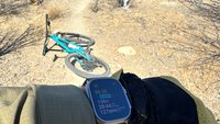
Looks like this is near the top of Gaglardi? Where does this trail come out at the other end?

Dec. 9, 2014, 3:05 p.m.
Posts: 32
Joined: June 10, 2013

Looks like this is near the top of Gaglardi? Where does this trail come out at the other end?

Yeah it is… it's the connector with Sidewinder. It just goes across mostly (parallel with University Drive).

Still not sure what the point of this connector is… maybe easier for people on that side of the mountain to connect to the trails? Part of future plans?

Dec. 9, 2014, 4:40 p.m.
Posts: 0
Joined: Oct. 7, 2006

The Sidebandit trailhead in the picture is just downhill from the light/intersection of Gaglardi and University Drive East (the first light going up the hill). From there you get a gentle climb with a few switchbacks and then it's pretty flat until it hooks up with Sidewinder at about the halfway point. From there upper Sidewinder is also pretty flat until it hits Mel's/Watermain. The lower half of Sidewinder is steeper but still a fairly easy climb. It ends at the pump station service road. The plan (this coming summer) is to extend it down to the bottom area of Nicole's/Gaglardi. I think the idea, beyond just expanding the network, is to provide a climbing option to the Gaglardi super freeway. These trails have no challenges save what the topography provides but they can still be fun (with speed). I use them to extend the length of some rides: dropping down from Mel's and going to the two bottoms and then back up to continue on Mel's.

fall any fall line

Dec. 12, 2014, 1:28 p.m.
Posts: 1150
Joined: Oct. 31, 2006

Yeah, basically the goal of the City is to build a climbing trail from the gas line (exit of Nicole's and Lower Snake). You will ultimately climb "Lower" Sidewinder to the water reservoir road. Cross that onto the existing Sidewinder. Then turn onto Sidebandit and climb to near the top of Gaglardi.

At this point the City or SFU will create a crush or asphalt sidewalk across the median to the traffic lights. Once across the lights, you climb the new bike lane for about 100m until you hit the Powerlines/watermain right of way. When this was rebuilt last year, it was finished off as a gravel/crush access. So, you can turn right onto this for a nice climb right into the Naheno Park trails.

So now you've got a nearly full offroad, largely singletrack loop (both up and down) on the south facing side of Burnaby Mtn.

I look forward to trying it out when it's done.

Dec. 12, 2014, 5:37 p.m.
Posts: 1150
Joined: Oct. 31, 2006

Update on trails after the big blow.

Lots of trees were down this morning all over the mountain. Maybe the south facing side got hit harder? Not sure. Seemed City crews were pretty quick on the lower trails with lots of signs of chainsaw action on Lower Snake.

Mostly nothing over 3" to 5" diameter on Mel's or GJ, so I was able to hand clear most of it on my way up the mountain this morning just with the folding saw in my pack.

Naheno has 3 big trees down and I've requested SFU Facilities to remove. No choice but to hike over them for now unless trials is your game.

GJ weathered this first 3 day storm very well and it was riding nicely this afternoon. Down to base flows. I was also on the trail during the height of the storm and nothing was breaching the new drainage. Lots of water on the trail as it was raining HARD and ground was saturated. But this morning, 5 hours after the rain stopped (according to the weather station at the top), the flows were well controlled and Upper GJ was remarkably dry (drier than Nicole's by a long shot). Upper GJ is running really fast right now it's so buff, so be mindful of hikers and uphill riders - they both have priority.

Middle GJ was nearly through its flow cycle, with all surface flows and ground water seepages finding their way to the new culverts and trenches that have been created.

The wettest portion of middle GJ has always been the two flattish sections of switchback heading to the right of way (Powerlines). This portion of trail was also benched the wrong way and doesn't cross-slope shed the water well, plus some ground water comes out along the cut bank. So, this has largely been corrected by allowing the water to run for short distances along the trail and then creating cross-cutting trenches into the forest. So you don't get long runs of water running down the trail; just shorter sections on hard base material (there will always be some water on the trail here and there during big storms).

The roller/jump at the right of way that was created earlier by Jay Hoots and the City to deflect water from ripping down the trail onto Lower GJ and UpperCut was being short-circuited and still raging. A new drainage trench has been created in front of the roller/jump and it's now bone dry on the landing side, so you can land, get in control before the next ground water seep (which also now channels off the trail before Lower GJ). There is some puddling on the topside of the roller/jump, but this will be corrected early next week with a drain grabbing upstream flows, and a rock trench overtop for surface flows. Just letting it dry out a bit. So the river flowing down Lower GJ and onto UpperCut is now gone. It was already dry this morning.

Flow meters show that we are back to normal storm flows. Trail surface touch-ups will be done in the spring. But for now, we're perhaps looking to be even better than before.

Dec. 12, 2014, 7:33 p.m.
Posts: 3834
Joined: May 23, 2006

Ulots of signs of chainsaw action on Lower Snake.

.

That was there last week. There's more?

Freedom of contract. We sell them guns that kill them; they sell us drugs that kill us.

Dec. 12, 2014, 10:49 p.m.
Posts: 0
Joined: Oct. 7, 2006

Thanks-again Whitehonky. Very thorough and I appreciate every detail. Your descriptions are good and I always know where you are referring to.

I said I wanted to get up their during the storm too. But at least from where I sit, I had a hard time telling when the storm was on and not. It was chaotic and the rain warnings were deceptive. I thought my roof was going to blow off yesterday, so I can imagine how much wood has fallen on the trails. I will bring my saw for then next while and help out.

Very good to hear that the trails dealt with the water so well. Its the long term that is key, right?

Thanks again, and don't stop reporting.

fall any fall line

Forum jump: