not having any luck w/google…….?
Freedom of contract. We sell them guns that kill them; they sell us drugs that kill us.
not having any luck w/google…….?
Freedom of contract. We sell them guns that kill them; they sell us drugs that kill us.
When you are ready they will find you.
http://www.metrovancouver.org/about/maps/Maps/LSCRTrailMap.pdf
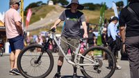
It's the squiggle of lines between Hyannis Connector and Bridle Path. Follow the signs when you ride north from the end of Hyannis. Pretty easy to find. Hang a right at the exit of Wills Way and follow the climb up to Bridle. 20 minute loop or so.
The intent of HSL is to provide a beginner/intermediate line, so hardly qualifies as a "when you're ready, it'll find you" trail. Next time you're at Dunbar Cycles, thank them for adopting it this year!
The blue is the climbing route, the green the downhill route. Here's a tidbit about that too. Purple are the mysterious secret trails known only as HC, BP, WW and BP.
http://nsmba.ca/content/2014-06_climbing-trails
High school in search box
http://nsmba.ca/content/2013-07_high-school-league-trail-project-phase-2-starting-mid-july
Fine. Now what are those single tracks up-slope of Bridlepath called?
Freedom of contract. We sell them guns that kill them; they sell us drugs that kill us.
Fine. Now what are those single tracks up-slope of Bridlepath called?
You're welcome.
They all have signs.
You're welcome.
They all have signs.
Seriously, right ? ! ? There are other solutions
- read the trail signs
- get a map
- be polite and thank you
Sheesh !
AND THANK YOU!
=/
Gee, sorry to seem underwellmed and all but I had somehow thought HSL trails encompassed the new stuff up-slope of BP and was hoping for a map of said but yeah I can just pedal and look and did see the micro sign of what must have been designating the uphill section of HSL but in passing quick took it to be the Wills Way closed signage.
Maybe the peeps I seen coming down from above were on a new extension of that trail that starts way up under the powerline what's it called, "Aftertaste"?
Freedom of contract. We sell them guns that kill them; they sell us drugs that kill us.
Ride Dales and you'll find it.
OK I get it, Trailforks.com, all has been revealed…… :o
Freedom of contract. We sell them guns that kill them; they sell us drugs that kill us.
Forum jump: