Me and two buddies embarked on the Misty Traverse last Wednesday and over the Easter weekend beginning from the Horstman Glacier from Blackcomb, across the Misty Icefields and exited along the west ridge connected to remote peak, down some logging slash/roads to the north end of Pitt Lake.
Day 1 Started with taking the lifts up to the Horstman Glacier and following the Spearhead Traverse until the Naden Glacier. We then Dropped down the Naden and made first camp at the foot of the McBride.

Along the Spearhead.

First camp at the bottom of the McBride looking towards Chekamus.
Day 2 We went up the McBride glacier to the west shoulder of Mount Sir Richard and made our way to the Gate Keeper where we would peel off from there and go down the valley down the North Tuwasus and camped at the confluence of The Tuwasus Creek, North and South Tuwasus.

Heading up the McBride toward Mt Sir Richard

Skiing down below the Gate Keeper.

Going down the North Tuwasus.

Camp site for the night.
Day 3 We left early to take advantage of the frozen slopes as we skied up the valley of the South Tuwasus onto Snowcap Lake. We reached Snowcap lake well before noon and decided that it was a rest day after the previous big days we had. We tented on the causeway on Snowcap Lake and sat in the sun for the rest of the day.

Heading up the South Tuwasus.

Snowcap Lake.

Chilling out on the causeway.

It's a hard life at times….

Open water by the causeway.

Mt Pitt in the setting sun.
Day 4 Gaining a weather forecast for the following days on day 3, we knew that a system was coming our way and he made a decision to finish the traverse before we get tent bound in bad weather. We left Snowcap lake made our way up to Snowcap peak, which we summited. We dropped onto the Misty Glacier towards a col that would bring us onto the Stave Glacier. We carried on over the Stave and made our way to Pukukul Lake where set up camp.

The morning sun against our camp site.

We still had a bluebird day that day.

We had to at least bag ONE peak. Went up and down Snowcap Peak.

On the Misty Glacier heading towards the Stave Glacier.

On the Stave Glacier heading towards Pukukul Lake.

Arrived at Pukukul Lake just in time to enjoy the setting sun.
Day 5 This was the day that bad weather was forecasted and we were determined not to get caught. We set out from Pukukul lake and made our way towards Old Pierre. Dropped onto a small neve and headed towards a ridge west of Remote Peak. Gaining the ridge, we dropped over onto the SW face into the tree line. We made our way to a logging camp called Alvin in the mid afternoon and decided to call a gazebo home for the night.

The moon in the morning of.

Bee lining it towards Old Pierre.

Descending one of the avalanche chutes south of Old Pierre.

What is a ski trip without a boot pack. The last ridge to climb over on one of the shoulders west of Remote Peak.

Big packs with skis to make them even heavier. We arrived at the logging camp in Alvin.
Day 6 Skis on our back, we had to travel about 9km to the jeti on the North end of Pitt Lake. The flight back to Pitt Meadows airport was a special treat.

A long walk to Pitt Lake.

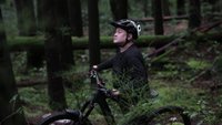
Picture thrown in for artistic value

Here comes our ride out.

Loading up the float plane.

A very cool way to be ending a trip.

Flying over Golden Ears Bridge.
The traverse was completed sooner than planned but we managed to make most of the perfect window with regards to the weather.
Thanks for reading…. sorry if there were too many pictures attached.