New posts

Chilcotins - Spruce Lake

July 28, 2014, 10:46 a.m.
Posts: 8848
Joined: Nov. 19, 2002

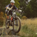
thanks for all your work flagging and bucking out fallen trees up there, Craig and Ina, life saver! There were lots of big cat prints in the fresh mud too, I forgot to mention, me and one other guy were ahead of the rest of the group and they actually rode up to a cougar sitting on the road watching the two of us ride ahead of the others….it didn't hang around very long!

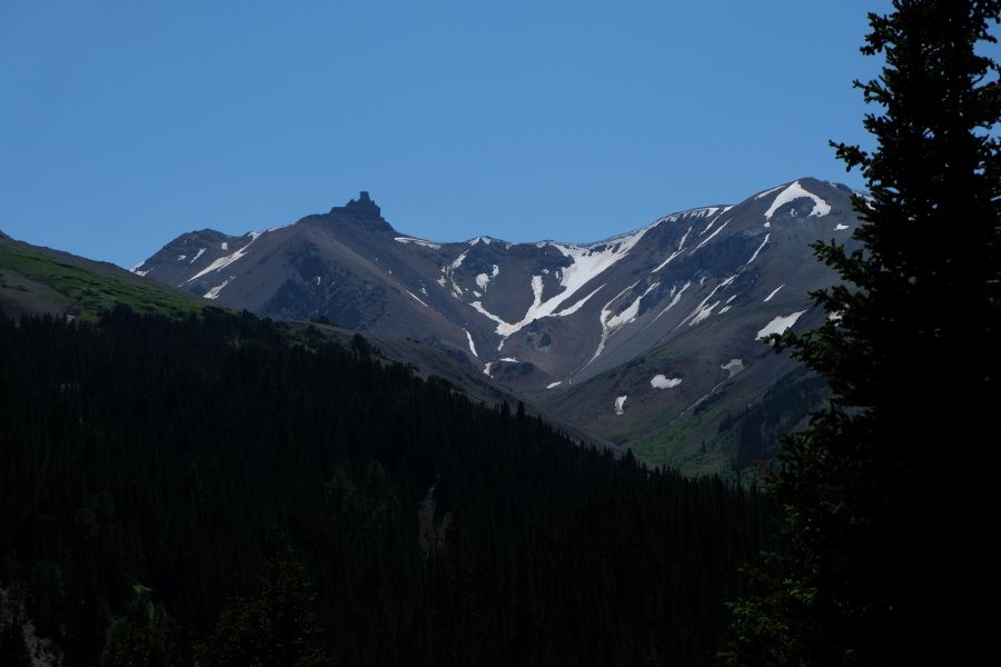
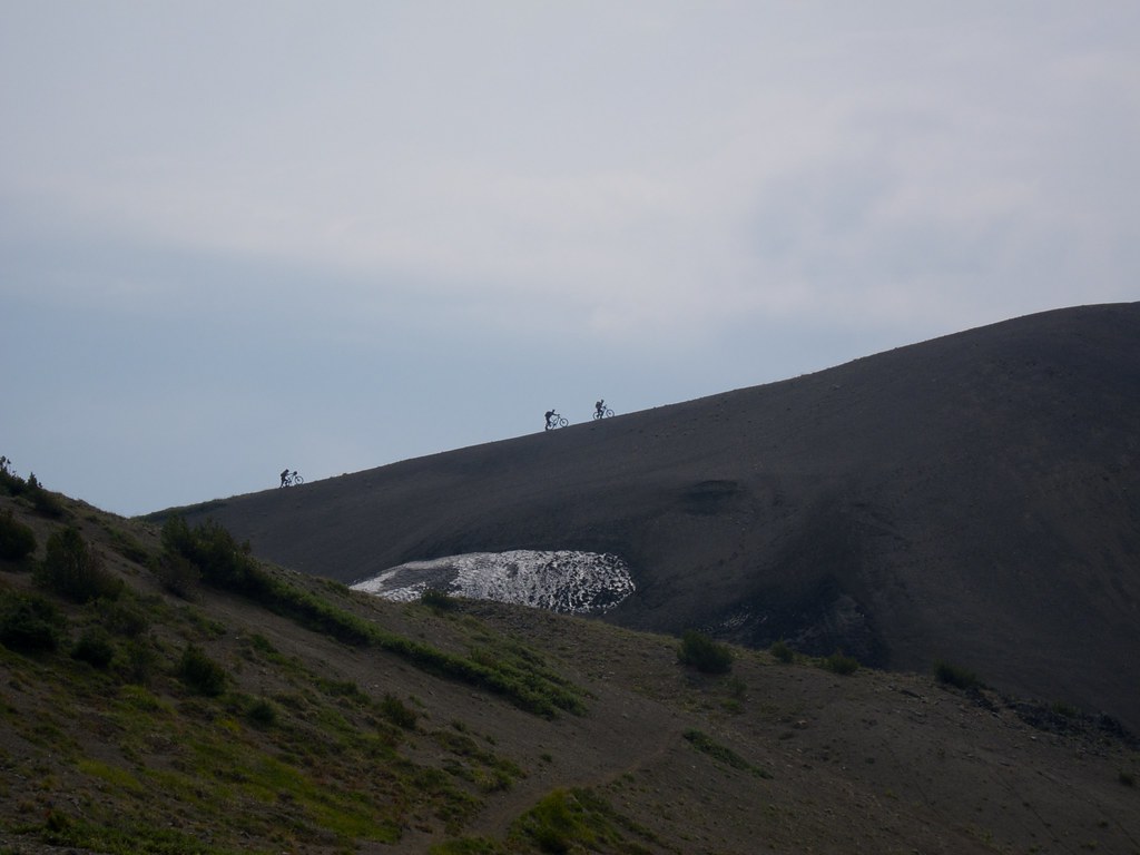
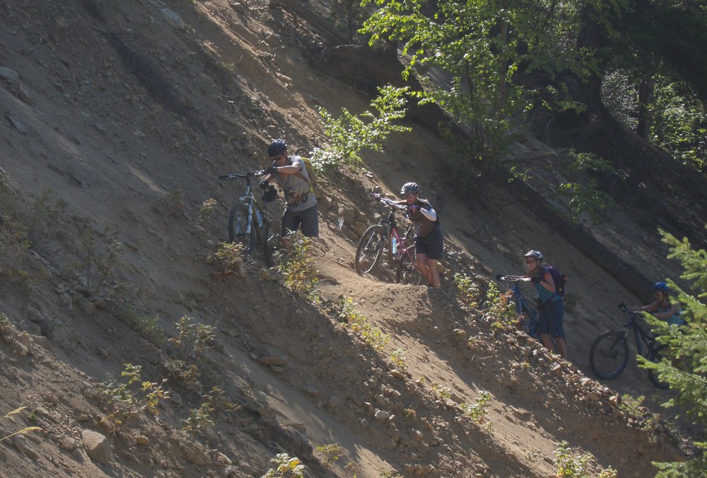
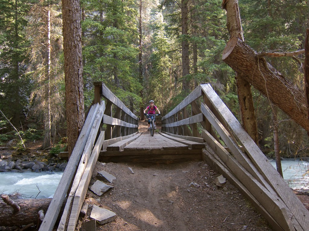
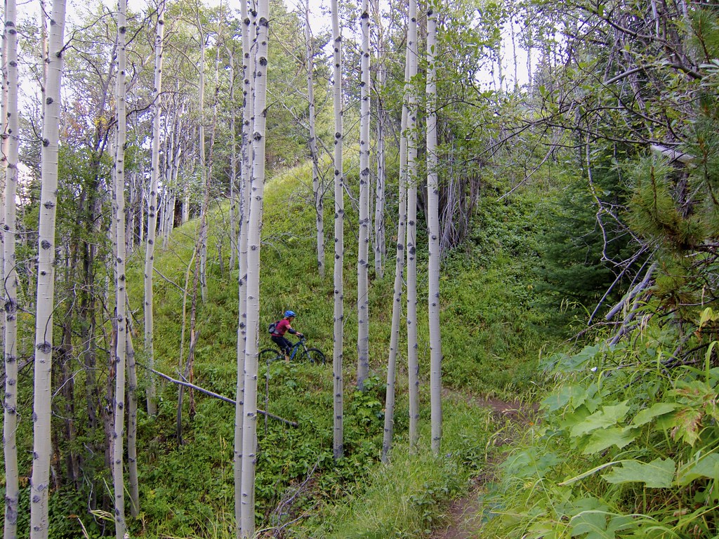
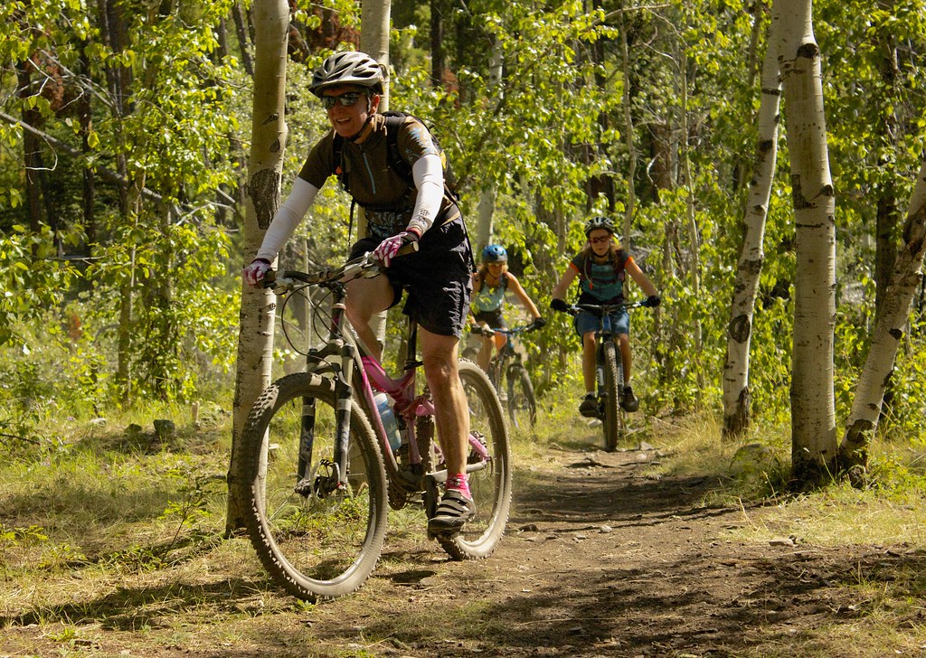
The one route tip I'd give is that after riding the flank of fortress for a bit you come to a huge meadow, stay high, there's flagging you should follow, we dropped a bit lower and had to hike a bike through the forest, but found the flagged route again on the other side….the descent to Tyaughton Creek trail is super fresh and fun!

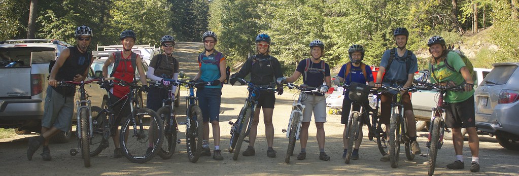
You're welcome! Also need to give thanks to Dale N. since he has been there with us on every trip. Chris B. too, he put in a hard day of saw work when we started the project.

We've seen the cat prints up there too, but never actually seen one. We have seen Bobcat/Lynx a few times. Last trip we saw a Wolverine.

We've seen lots of sign of both grizzly [HTML_REMOVED] black bear up there, but never seen them in either of these valleys. We're loud in these valleys though as we don't want to surprise them.

I wouldn't necessarily follow all of our flagging tape on Fortress, some of it was put in while we were exploring to find a decent way across the section shown as "a route" on the map. Navigation is still required.

July 28, 2014, 12:08 p.m.
Posts: 141
Joined: July 31, 2009

Craig,

We camped in the valley before the pass around where the campsite marker was on the map.

We saw a black bear about 200m from our camp just before we were thinking of heading to bed. Made lots of noise to scare it off and stayed up for an hour or so longer making lots of noise and light with our headlamps to make sure it new we were still there.

We didn't get lost on the trip but did have some non optimal routes through some of the sections.

In the morning after the camp you end up crossing the small creek a few times. Had Teva's on for the first time but then just got feet wet for the others. After a short while you see a creek coming down the slope on the left. The traverse to the summit starts there. We missed it so put some switch backs in to get up to it. The map shows it correctly.

In the meadows Todd was talking about we followed his tracks for a while, your flagging for a bit. Got into the forest a little early but then found the traverse path to get into the opening at the bottom of the rock field. I think if I were to do it again I'd have fun dropping through the meadow then using the GPS cut across at the traverse line.

For navigation I took the map and scanned the section. Clipped it to the appropriate UTM 5km grids and resized it so it had 3 metres per pixel. Then saved as TIFF. Created a TIFF world file to geo-reference it. Then I could convert to a geo-spatial pdf viewer so you can use it in PDF Maps app on the iPhone/Android. Using the TIFF I also created GPX files by manually tracing the image for the appropriate routes. The PDF maps on an iPhone 4G was accurate enough to see where you were on the map.

July 29, 2014, 1:36 p.m.
Posts: 333
Joined: Dec. 21, 2008

Hey all: I know it has been asked before, but does anyone have any suggested day-rides to do out of Spruce Lake. I will be there with my 14 yr old son and a couple of friends in a few weeks. First time in the southern Chilcotins and we are pretty excited. Also, where is the best place to pick up a map?

July 29, 2014, 8:54 p.m.
Posts: 2009
Joined: July 19, 2003

that seems like a lot of rig-a-ma-roll for a casual 8 hour ride.

things are looking pretty nice out there.

Just a speculative fiction. No cause for alarm.

July 29, 2014, 9:31 p.m.
Posts: 8848
Joined: Nov. 19, 2002

that seems like a lot of rig-a-ma-roll for a casual 8 hour ride.

Mapping is his biz, I'm guessing it didn't take him long.

July 29, 2014, 10:21 p.m.
Posts: 0
Joined: Dec. 3, 2004

Hey all: I know it has been asked before, but does anyone have any suggested day-rides to do out of Spruce Lake. I will be there with my 14 yr old son and a couple of friends in a few weeks. First time in the southern Chilcotins and we are pretty excited. Also, where is the best place to pick up a map?

Pemberton Bike Co has maps for sale and its on your way up. High quality, tear resistant, water proof, detailed maps for $20. Gun Creek would be a good first try. Windy Pass is a bit of a hump out of Spruce but if you and your group are up for it, it's a fantastic view from the top.

Shed head!

July 30, 2014, 6:16 a.m.
Posts: 2307
Joined: Sept. 10, 2012

Pemberton Bike Co has maps for sale and its on your way up. High quality, tear resistant, water proof, detailed maps for $20. Gun Creek would be a good first try. Windy Pass is a bit of a hump out of Spruce but if you and your group are up for it, it's a fantastic view from the top.

Maps: http://www.trailventuresbc.com/maps/south-chilcotin/order-chilcotin-map

You can also ride Tyaughton Creek Trail west from Spruce Lake with one significant creek crossing to get over. Wasn't too bad 2 weeks ago.

Aug. 6, 2014, 9:15 a.m.
Posts: 333
Joined: Dec. 21, 2008

Thanks for the info guys.

Aug. 11, 2014, 10:09 p.m.
Posts: 333
Joined: Dec. 21, 2008

Just perusing the maps and am looking for suggested routes from Spruce Lake back to Tyax. Is the Windy Pass/High trail/Lick Creek route realistic with full packs? Are there better alternatives than the Gun Creek trail?

Cheers.

Aug. 12, 2014, 7:40 a.m.
Posts: 160
Joined: Nov. 19, 2002

Just perusing the maps and am looking for suggested routes from Spruce Lake back to Tyax. Is the Windy Pass/High trail/Lick Creek route realistic with full packs? Are there better alternatives than the Gun Creek trail?

Cheers.

those are pretty much your options. What do you mean by "better alternatives"? Gun Meadows/Gun Creek is fun and straightforward, Windy/Lick will add significant amounts of climbing and hike a biking.

Aug. 12, 2014, 3:46 p.m.
Posts: 333
Joined: Dec. 21, 2008

OK, thanks. By "better alternatives", I don't mean less effort required. I mean more epic views, more alpine, more enjoyable down-hill sections. I don't want to miss out on any of the 'must do' trails in the area. Will probably hit up Windy Pass as a day-trip at least. Just trying to figure out if we should ride back out to Tyax that way or take the Gun Creek trail.

Aug. 13, 2014, 7:27 a.m.
Posts: 141
Joined: July 31, 2009

I'm wondering what your definition of a "full" pack is.

If you mean a 30-40L pack with overnight gear then it'll be a bit more of a grunt going up windy pass. You'll also find that it's difficult to get your head in a good riding position as your helmet will hit the pack for the steeper sections of the lick descent.

If you mean a reasonable size pack with all your tools, spare long sleeve, rain jacket, food, at least 2L of water and a few first aid items. Then that's the minimum for what you should be using anyway for most rides in the Chilcotins or any remote back country area.

Gun creek trail is a fun trail with some good views on the upper sections (don't forget to stop and look behind you for the best views). It's only about 3 hours from the lake back to the road and then another 30-45 back to Tyax. So pretty short.

If you want the epic views then up over Windy to lick is pretty awesome. Until last year we said I'd never ride/hike up in Windy from spruce (we've done it the other direction). It wash't actually as bad as we'd thought. I was actually able to ride more than I would have thought.

Aug. 13, 2014, 5:15 p.m.
Posts: 333
Joined: Dec. 21, 2008

Great info, thanks alot!

Aug. 17, 2014, 4:33 p.m.
Posts: 2307
Joined: Sept. 10, 2012

I just got back from another Chilcotins trip. This time we had our gear flown in by float plane to Spruce Lake and we rode our bikes in and out of the lake unencumbered. It was a big group of 17 riders, but it worked out pretty well with smaller groups forming each day to tackle different rides. We had enough people so that everyone could find at least one other rider who wanted the same sort of adventure each day.

The use of a plane to haul our stuff meant that folks who couldn't easily tackle a mountain bike tour could participate and we could haul a few luxuries like beer!

This was a Dirt Hombres bike club trip so there was some club swag on display.

This was the first Chilcotins trip for everyone, but me so they learned fast you had to earn your turns even with a float plane hauling gear.

I've been getting my GF stoked on MTB touring a little bit at a time. Doing over nighters and now this trip to the Chilcotins. I want to show her why getting off the beaten track on a MTB is so great. So far mission accomplished.

We encountered a lot more horses on this trip than I have in the past trips which were all in July. For the most part the horse folks were pleasant to deal with although riding through piles of steaming horse $hit ain't all that great!

Our local riding on Vancouver Island is very steep, very techy with tons of rocks and roots and generally shorter trails….so the smoother and longer rides we did in the Spruce Lake area were a nice change of pace for everyone.

On my last trip in July I watched a tour buddy catch a bunch of trout in a small creek so I brought a rod on this trip and had a ton of fun catching trout in the lake. In fact I'd say this was definitely one of the highlights of my trip. Next time I'm bringing an inflatable boat!

Since I am not a big fan of eating fish I donated my catch to my friend's stoves for their enjoyment.

Unlike my last trip which was all guys this trip was more than 50% ladies and they shredded hard each day. :thepimp:

The only photo of me on a bike! I really enjoyed having an unloaded FS bike to ride. :agree:

We were lucky and had no serious injuries or mechanicals for our 5 days in the backcountry.

My GF givin'r in the forest. I was happy to have a DSLR on this trip for some better quality photos. :grinno:

The big group was fun, but I did manage to get away for a solo assault on Windy Pass on the one day with some decent rain. Being up high in the clouds alone with cool weather and hero dirt made for a fun ride.

Here is some of the crew. Everyone was talking about next year so I figure we'll likely be back in 2015. :rocker:

I posted the trip photos to Flickr if you want to see them.

Aug. 18, 2014, 1:30 p.m.
Posts: 8256
Joined: Nov. 21, 2002

17 riders

:|

WTB Frequency i23 rim, 650b NEW - $40

Forum jump: