New posts

Chilcotins - Spruce Lake

July 24, 2014, 12:23 p.m.
Posts: 8848
Joined: Nov. 19, 2002

Just read this on http://www.southchilcotin.ca Facebook page

RAIN!! Lots of it all night long! Road 40 to Lillooet is closed indefinitely. www.DriveBC.ca is not reporting the road closure but I just called Lillooet Interior Roads office and they confirmed it is closed. Crews are assessing the situation. They are dealing with debris flow issues in various locations and will update as more information comes in.
Drivebc.ca have posted the closure now: Debris on Highway 40 Both directions - Closed in both directions from Gold Bridge to Junction with Highway 99, due to multiple mudslides. Estimated time of opening currently not available. No detour available. Next update 10:00 am. Updated on Thu Jul 24 at 8:38 am PDT. (ID# 171264)

One of the highway Twitter accounts posted that that the Hurley is still open.

BC Transportation @TranBC · 2h

RT @SLRD_Emergency: Overnight mudslides have closed Road 40 b/w Lillooet and Goldbridge. Follow @DriveBC for more info. Hurley remains open.

July 24, 2014, 12:54 p.m.
Posts: 8848
Joined: Nov. 19, 2002

I've started a ride report that's about 50% done here: http://forums.mtbr.com/bikepacking-bike-expedition/chilcotin-mountains-bike-tour-923010.html

Great trip report, looking forward to reading the last day.

That is weird that you couldn't find the trail up Elbow Pass. I was at the back of the group that day as I had a slightly twisted ankle, but don't recall it being difficult to see. That said it was 6 years ago, maybe the amount of traffic and erosion had obscured the trail?

http://www.leelau.net/sharonandlee/day-3-graveyard-elbow-lorna-tyax-deer-pass-spruce-lake/

I think I'm the rider/dot in the distance.

We've just started doing the self supported Chilcotin rides this year, but we have experience doing offroad self supported touring.
Our previous trips up there were using horses from Spruce Lake Wilderness Adventures [HTML_REMOVED] day trips either using Tyax's float plane or riding in from one of the park boundary trail heads.

July 24, 2014, 2:40 p.m.
Posts: 2307
Joined: Sept. 10, 2012

Great trip and photos! Makes me more stoked for my next couple of trips up there.

That's an interesting bag that sits along the top tube (pic #8434). What do you keep in there and where did you get that?

Sorry not my bike. That is an extedned TT bag Bruce got made. Provides some extra carrying capacity, but looked pretty floppy. Not sure I'd want to deal with that.

You might be able to reinforce it with a plastic stiffener to help it hold its shape.

July 24, 2014, 2:42 p.m.
Posts: 2307
Joined: Sept. 10, 2012

Great trip report, looking forward to reading the last day.

That is weird that you couldn't find the trail up Elbow Pass. I was at the back of the group that day as I had a slightly twisted ankle, but don't recall it being difficult to see. That said it was 6 years ago, maybe the amount of traffic and erosion had obscured the trail?

Apparently it's not too hard to find going east to west, but we were going the other way and the trail ends at a river crossing with a big swampy meadow on the far side.

As it turns out the ride down the east side of Lorna Pass was so good we would have been sad to miss it so things worked out great. :clap:

July 24, 2014, 2:43 p.m.
Posts: 2307
Joined: Sept. 10, 2012

leaving tonight for 4 days up there, stoke levels increasing by the second and focus on work has left the building!

Have a great trip. :) I'm really stoked to go back in a couple weeks with an unloaded FS bike. :clap:

July 24, 2014, 2:52 p.m.
Posts: 8848
Joined: Nov. 19, 2002

Apparently it's not too hard to find going east to west, but we were going the other way and the trail ends at a river crossing with a big swampy meadow on the far side.

As it turns out the ride down the east side of Lorna Pass was so good we would have been sad to miss it so things worked out great. :clap:

I'll have to look at the map when I get home. I can't think of where you were.

July 24, 2014, 3:48 p.m.
Posts: 141
Joined: July 31, 2009

Apparently it's not too hard to find going east to west, but we were going the other way and the trail ends at a river crossing with a big swampy meadow on the far side.

As it turns out the ride down the east side of Lorna Pass was so good we would have been sad to miss it so things worked out great. :clap:

Right I remember that creek crossing. We did find the trail however. After that the bugs were super bad on the climb up. The descent from Elbow is super fun too! Coming from the Graveyard area is a much nicer way to do Elbow.

July 24, 2014, 4:09 p.m.
Posts: 2307
Joined: Sept. 10, 2012

I'll have to look at the map when I get home. I can't think of where you were.

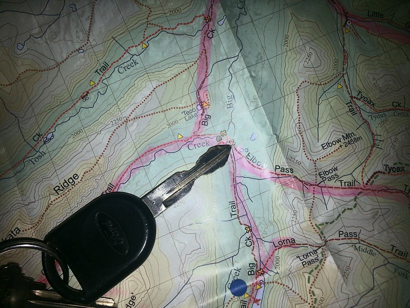
We were at tip of key heading east.

Spoke to hiker that had come the other way and he had no issues going east to west, but even having done that he couldn't find the trail going west to east.

July 27, 2014, 8:52 a.m.
Posts: 160
Joined: Nov. 19, 2002

Just read this on http://www.southchilcotin.ca Facebook page

RAIN!! Lots of it all night long! Road 40 to Lillooet is closed indefinitely. www.DriveBC.ca is not reporting the road closure but I just called Lillooet Interior Roads office and they confirmed it is closed. Crews are assessing the situation. They are dealing with debris flow issues in various locations and will update as more information comes in.
Drivebc.ca have posted the closure now: Debris on Highway 40 Both directions - Closed in both directions from Gold Bridge to Junction with Highway 99, due to multiple mudslides. Estimated time of opening currently not available. No detour available. Next update 10:00 am. Updated on Thu Jul 24 at 8:38 am PDT. (ID# 171264)

we came from della thursday evening, we made it through, but the slides were extensive, definitely 4x only around a couple of them….I didn't get any pictures myself, but they were very impressive. We had more than a few fresh debris flows to get through on our Castle Pass epic Friday too, lots of muddy feet!

July 27, 2014, 10:57 a.m.
Posts: 160
Joined: Nov. 19, 2002

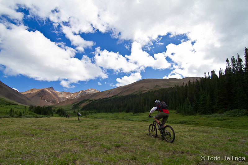
Castle Pass adventure, lots of route finding along the way, that and some beta from friends who rode it a couple weeks ago was essential. Views and area are spectacular, the previous days rain unleashed a whole lot of debris flows, and we had to crosses several still wet and muddy deposits of material, the creeks were all running high as well.

Approaching Castle Pass

Todd Hellinga-0381 by T.odd View, on Flickr

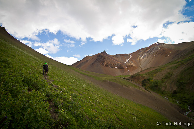
Hike a bike

Todd Hellinga-0397 by T.odd View, on Flickr
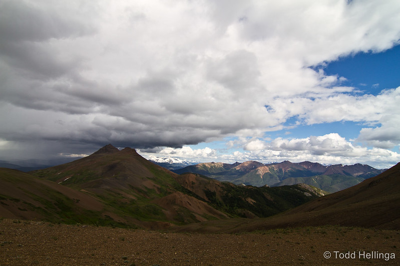
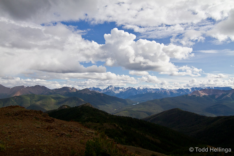
view northish from the pass

Todd Hellinga-0425 by T.odd View, on Flickr


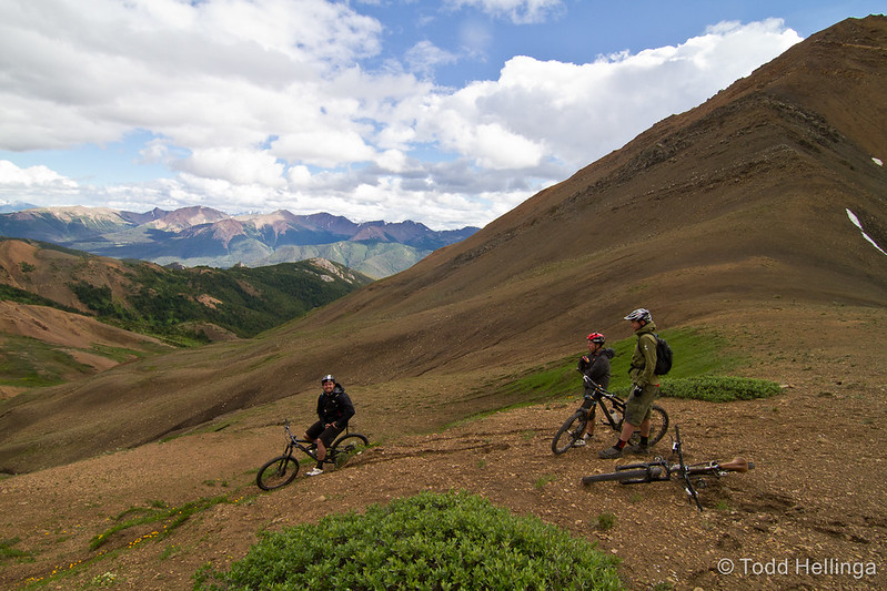
Todd Hellinga-0429 by T.odd View, on Flickr

Looking over Spruce Lake and beyond

Todd Hellinga-0442 by T.odd View, on Flickr

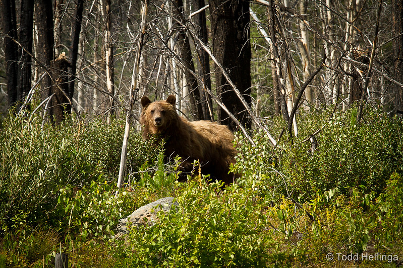
Saw this fuzzy creature too by Mowson Pond on the way home last evening

Todd Hellinga-0457 by T.odd View, on Flickr

July 28, 2014, 7:09 a.m.
Posts: 160
Joined: Nov. 19, 2002

Route 40 between the Dam and Goldbridge on Thursday evening….sorry for the one big pic, I ganked it off a friends FB feed…

July 28, 2014, 9:19 a.m.
Posts: 2307
Joined: Sept. 10, 2012

Thanks for all the Chilcotins photos. :clap:

They are keeping me going at work until I head back there in couple weeks. :heart:

July 28, 2014, 9:54 a.m.
Posts: 141
Joined: July 31, 2009

Castle Pass adventure

I think that is the best way to describe this route.

We did a two day version of this loop on Saturday/Sunday. Slow going with the extra weight of overnight gear. Especially with the softness of the deactivated road and trails on the first day after the torrential rain last week.

Did you spray paint some rocks in orange at the river by the debris flow after the log crossing? Was trying to figure out of the debris flow was new or just got rain soaked. CraigH was it there last time you came through?

Pics and TR to come

July 28, 2014, 10 a.m.
Posts: 8848
Joined: Nov. 19, 2002

Did you spray paint some rocks in orange at the river by the debris flow after the log crossing? Was trying to figure out of the debris flow was new or just got rain soaked. CraigH was it there last time you came through?

That debris flow at the 3rd creek crossing was pre-2008 (first time I was up that valley) but more might have come down since. (There is a report somewhere online about that debris flow, but I can't remember where.)

Edit: Pre-2006, a trip report on ClubTread http://www.clubtread.com/sforum/topic.asp?TOPIC_ID=17939

The spray paint is new and not mine, it has appeared since my last trip up there last summer. I'd never use paint as a trail marker.

July 28, 2014, 10:23 a.m.
Posts: 160
Joined: Nov. 19, 2002

thanks for all your work flagging and bucking out fallen trees up there, Craig and Ina, life saver! There were lots of big cat prints in the fresh mud too, I forgot to mention, me and one other guy were ahead of the rest of the group and they actually rode up to a cougar sitting on the road watching the two of us ride ahead of the others….it didn't hang around very long!

The one route tip I'd give is that after riding the flank of fortress for a bit you come to a huge meadow, stay high, there's flagging you should follow, we dropped a bit lower and had to hike a bike through the forest, but found the flagged route again on the other side….the descent to Tyaughton Creek trail is super fresh and fun!

Forum jump: