if you have a map, and know how to use it, it's not that hard to get around.
if you have a map, and know how to use it, it's not that hard to get around.
happy to write something up. though there's lots out there, i would appreciate more "first timer" pov reports at this point
one thing i'd like advice/crowdsoured feedback on: would i be nuts not to take a "warm" (i.e. down) layer for a 4 day self supporting/camping trip? forecast is calling for lows around 7* but in the mountains all bets are off i figure
"Nobody really gives a shit that you don't like the thing that you have no firsthand experience with." Dave
Pat has a nice blog article posted about his first Chilcotins ride of the year:
http://patmulrooney.blogspot.ca/2014/06/south-chilcotin-2014-season-opener.html
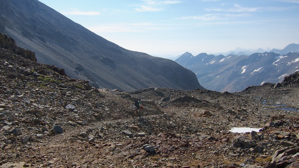
I'm heading in for a week long tour in a couple weeks. Flying into Lorna Lake and doing some loops before riding back to Tyax.
http://dirthombres.wordpress.com/2013/09/26/chilcotins-2014-mountain-bike-tour/
Then after a couple weeks at home I'll be going back with a bigger group riding in to Spruce Lake and having our gear flown in/out by Tyax for a 5 day trip. It will be nice to share the trails with my GF and ride my unloaded FS bike.
I've been planning these trips for a long time. Excited to get rolling. :clap:
one thing i'd like advice/crowdsoured feedback on: would i be nuts not to take a "warm" (i.e. down) layer for a 4 day self supporting/camping trip? forecast is calling for lows around 7* but in the mountains all bets are off i figure
I did a 2nt/3day self supported bike camp trip in the South Chilcotins 2.5 weeks ago and was happy to have my down jacket with me at night and early morning (it doubled as a pillow too). CraigH packed his down jkt but never used it (he's more hot blooded than me :) . What works for one person may not work for another. Think layers, for warmth and to keep dry.
if you have a map, and know how to use it, it's not that hard to get around.
It isn't necessarily a navigation issue, I think for most people it is a "are you comfortable being far back in the bush, with no safety net, when the shit hits the fan?" issue.
~~~~~~
That said, even with a map and a gps, a few years ago I spent more than an hour searching for a trail intersection when I relied on a sign that wasn't clear.
one thing i'd like advice/crowdsoured feedback on: would i be nuts not to take a "warm" (i.e. down) layer for a 4 day self supporting/camping trip? forecast is calling for lows around 7* but in the mountains all bets are off i figure
Personally, I wouldn't do it although in years past I didn't have a light down jacket. I used a merino wool coat for that layer.
Check out Lee's bikepacking guide:
http://www.pinkbike.com/u/leelau/blog/Self-supported-Bikepacking-a-sample-packing-list.html
You'll probably have a hard time getting down to his pack weight unless you've bought lots of light/expensive gear.
ended up strapping my down jacket to my bag at the last minute; thinking back on the trip, i can't imagine not having brought it
Check out Lee's bikepacking guide
i did, it was helpful. my pack ended up being around 30lbs i think, but i brought a lot less butter than he did ;)
"Nobody really gives a shit that you don't like the thing that you have no firsthand experience with." Dave
^^ how many days was your trip? loops? recommendations? could we get away with a tarp, or are insects an issue in the evenings?
also, would a bob trailer work going in?
^^ we just camped at spruce w/ no tents or tarps. It was very nice.
Just got back from a week of MTB touring in the Chilcotins. Fun and very challenging trip. :fro:
The original plan was: http://dirthombres.wordpress.com/2013/09/26/chilcotins-2014-mountain-bike-tour/
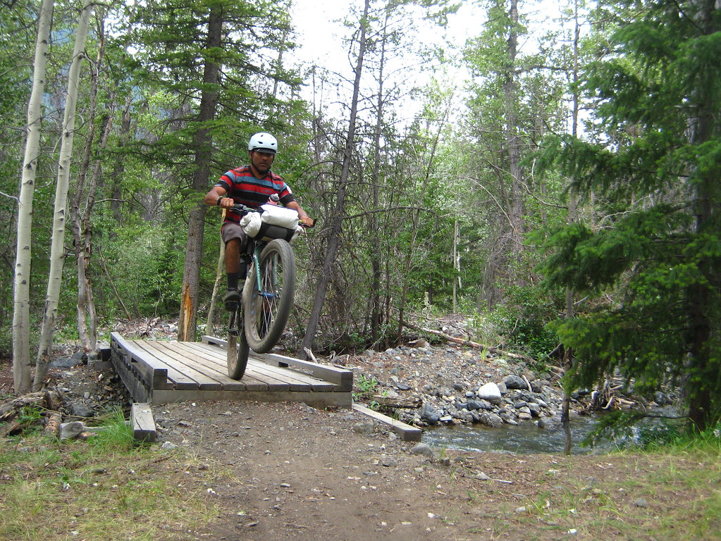
I've started a ride report that's about 50% done here: http://forums.mtbr.com/bikepacking-bike-expedition/chilcotin-mountains-bike-tour-923010.html
If you just want to see some photos you can find 'em here: https://www.flickr.com/photos/vikapproved/sets/72157645746023216/
I'm heading back with the GF and a bunch of friends for a Spruce Lake basecamp trip with my FS bike. It will be nice to hit the trails without camping gear! :rocker:
Thanks to everyone that provided advice and help planning the tour. :heart:
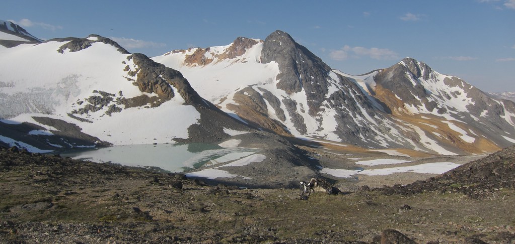
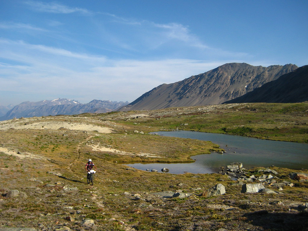
Looks like awesome ride. Glad we aren't the only ones who've tried the Warner pass route (last year). Great scenery up there but after all that slogging up from Taseko lakes the mainly non-ridable descent was a bit of a downer.
leaving tonight for 4 days up there, stoke levels increasing by the second and focus on work has left the building!
Looks like awesome ride. Glad we aren't the only ones who've tried the Warner pass route (last year). Great scenery up there but after all that slogging up from Taseko lakes the mainly non-ridable descent was a bit of a downer.
+1 - it would be better going east to west and riding down the west side of Warner pass. Then you could ride down Grant Creek Trail when you get over Iron Pass going west to east.
Really beautiful up on Warner Pass.
I learned a lot of this trip. Glad to see all the different terrain and passes.
I would definitely put together a different route if I was going to cover the same area next year.
Just read this on http://www.southchilcotin.ca Facebook page
RAIN!! Lots of it all night long! Road 40 to Lillooet is closed indefinitely. www.DriveBC.ca is not reporting the road closure but I just called Lillooet Interior Roads office and they confirmed it is closed. Crews are assessing the situation. They are dealing with debris flow issues in various locations and will update as more information comes in.
Drivebc.ca have posted the closure now: Debris on Highway 40 Both directions - Closed in both directions from Gold Bridge to Junction with Highway 99, due to multiple mudslides. Estimated time of opening currently not available. No detour available. Next update 10:00 am. Updated on Thu Jul 24 at 8:38 am PDT. (ID# 171264)
Just got back from a week of MTB touring in the Chilcotins. Fun and very challenging trip.
Great trip and photos! Makes me more stoked for my next couple of trips up there.
That's an interesting bag that sits along the top tube (pic #8434). What do you keep in there and where did you get that?
Forum jump:


