Review
Wahoo Element Roam GPS Bike Computer
Before we get started, I’m going to talk about what this review isn’t. This isn’t a deep dive into the technical capabilities of this device. This isn’t an in depth comparison between this device and other, similar ones. There are other resources that do that, and I’m not going to pretend to be an expert on GPS bicycle computers.
This review starts with a story. Earlier this year (yikes…last year!), I found myself riding solo from one tip of the (lower) Sunshine Coast to the other. Halfway through Day 1 I found myself over prepared in some areas (way too much food) and under in many others. I distinctly remember the point on the morning of my departure where I decided to throw a couple of extra granola bars in my bag, yet decided that I wasn’t straying too far from civilization so I could probably get away without my USB charger. Who needs to charge their phone when they’re only going to be riding for 5 or 6 hours?
9 hours later, with my phone dying and my legs dying and my frustration with the Trailforks app reaching a boiling point, I realized that a phone in your pocket is absolutely no way to embark on anything that requires any sort of accuracy in navigation. Indeed, it was only by stumbling upon three other gents in a similar state of disrepair that I was able to salvage the last portion of my ride. One of them had this magical device strapped to his handlebars that barked out turn-by-turn directions, so I tucked in on their wheels and promised myself that I would never place myself in that position again, especially when there might be real consequences to losing my way. Enter this device (recognizing that no electronic device should be your lone navigational tool for high consequence situations).
My GPS Experience
Some say hoarder, others say collector. One of the collections I like to keep is a log of the rides that I take. Not in the Strava type sense, where I keep track of how quickly I did things. More in the…shit…I don’t even know? I guess I just like to see where I’ve ridden and how different trails interact with one another. Yes, it’s possible to find a map of most bike trails that one would ride, but I enjoy the experience of throwing my 15-year-old Garmin GPS into my pocket at the start of the ride, and then seeing what that tells me by the end.
This is not a perfect device (my 15-year-old Garmin, that is). Figuring out where you are on that ridiculously small screen (especially considering the size of the device) is not easy. The software is difficult to use and you have to scour the Internet for basemaps (or, I don’t know, pay money for them or something) to make it functional.
But it works. And as long as I keep a copy of the DVD that holds the Garmin software, it will continue to work. And this is the starting point for what I want from a GPS device on my bicycle.
Overview
We talked about how we’re not going to go all that far technically on this thing, but I don’t want you to feel totally cheated. Here’s a summary of the features this unit provides, taken at random from this page here:
- ANT+ and Bluetooth support for all the bits you could ever hope to connect
- Automatic and wireless connectivity for updates, routes, workout uploads etc.
- USB rechargeable battery (via a rubber covered door at the bottom of the device)
- 2.7” Gorilla Glass screen with full colour display
- Estimated “up to” 17 hour battery life – Honestly, this seems pessimistic in my experience
Beyond that, it does most of the things you would expect from a modern cycle computer/GPS device (speedometer, cadence, route tacking/following, etc. etc. etc.).
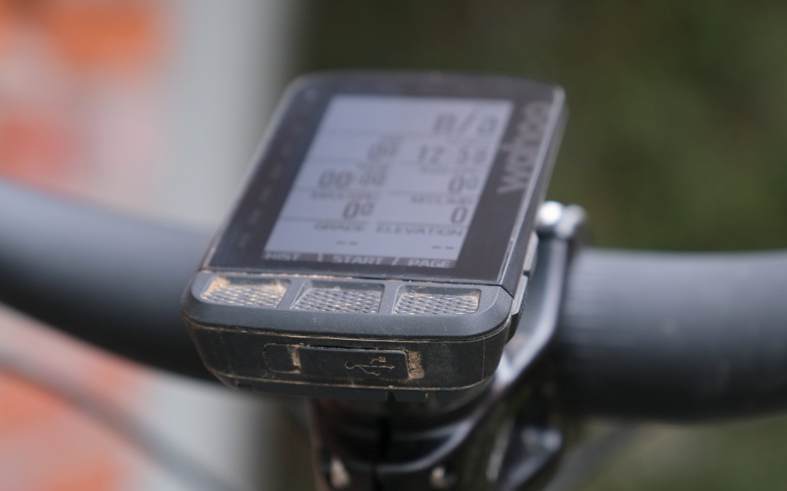
Dimensionally, imagine a credit card that is the thickness of a deck of cards, and you’d be pretty close. It has a power button on the side, and 3 buttons along the bottom of the screen. Scrolling through the various menus is fairly intuitive, with a minimal depth of menus. Everything is clean, basic and simple.
The final thing to note is the mount on the bottom, which looks exactly like a Garmin mount, and I’m told is identical save for the fact that it’s rotated 90 degrees. I wound up buying a K-edge stem mount for its universality, and I imagine this could work with any Garmin or Wahoo device, just by rotating it.
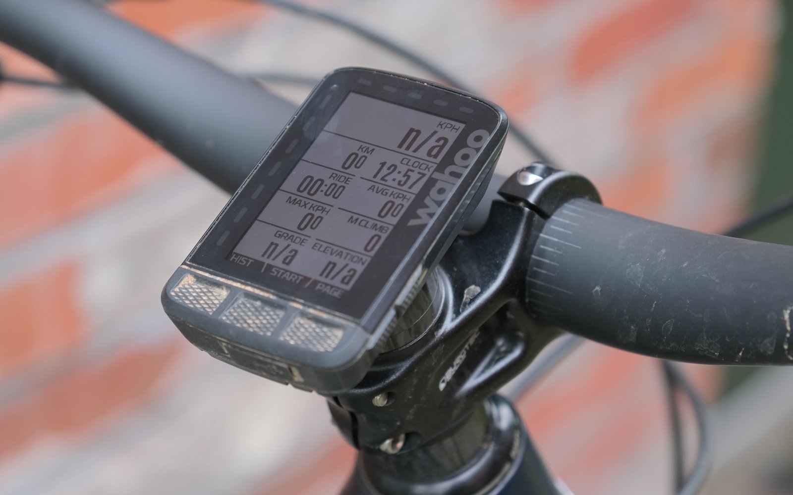
Can't wait to hear Dave Smith's complaints about these photos. Here is the typical view that you have of the device. You can use the zoom buttons on the side to give yourself more or less information, all the way down to just a giant speedometer display.
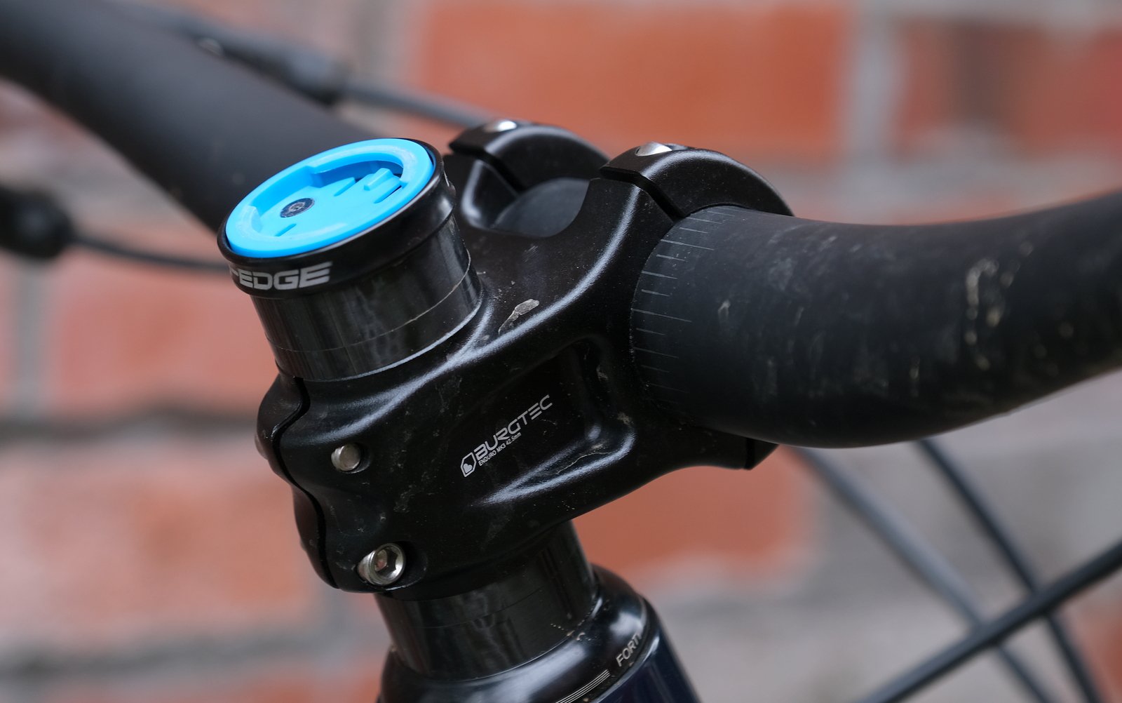
The K-edge mount. First off, yes, it is incredibly dorky to have a computer mounted on your stem. Also, it's incredibly difficult to mount this thing straight, and the two fiddly little screws aren't that fun to work with either. You never can really tell if it's straight until you have the blue piece on, it seems. So I'm getting used to mounting and re-mounting this thing an awful lot, as I switch back-and-forth between bikes.
Initial Set-up
Set up is super simple. Download the App, create your free Wahoo account, pair the device to your phone, follow the instructions on your phone and off you go (after strapping it to your bike with the included 31.8mm out-in-front or strap on stem mounts). It’s all about as simple and painless as one could hope from a modern device. Neither the Wahoo account, nor the phone connection/app are required, but without them you lose much functionality.
Pulling or sending data to the device is ever-so-slightly more challenging. There is the ability to send data back and forth from the device via the app/e-mail, but it’s a bit cumbersome. You’ll probably find it easiest to manage your data using any of the supported 3rd party apps (Strava, Ride With GPS, TrainingPeaks, Komoot, etc.) as this does everything automatically.
I had a conversation a few months ago about the technical proficiency of kids these days. Their point was that kids grew up immersed in technology so would thus achieve a mastery that we never could. My point was that everything works so easily these days, can you really claim to be a master of technology when nothing requires even the barest of frustrations? This device certainly won’t save our children from their future.
Base Maps
Wahoo includes base maps that cover what seems like every point on this earth. Further, they include free updates! Once you get into the mountains, trail coverage is fair. It’s probably not going to tell you anything that you didn’t already know about your local trails, but that’s probably for the best. Geographical data is pretty sparse, and there is no support for 3rd Party Base Maps if you need more than what is offered. If you really need to figure out where you are, or what that trail over there is called, it’s not the best for that. This was the first lesson, for me, about this being more of a cycle computer than a fully functional GPS device.
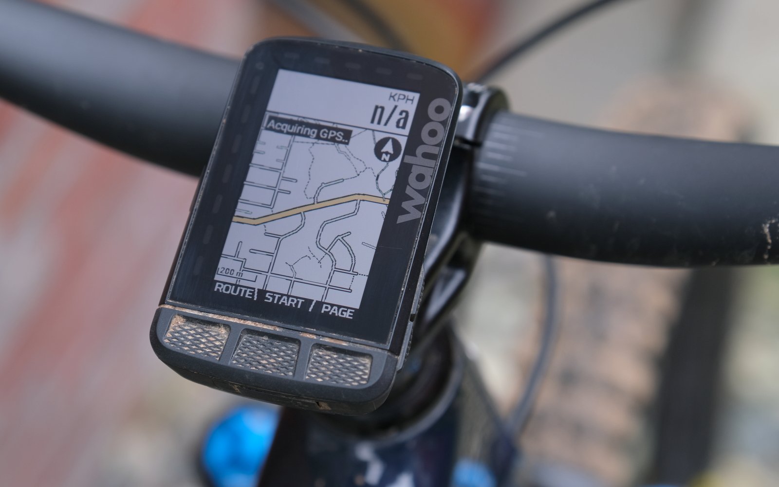
Here's a fairly typical map view.
App Connectivity
At first I was bothered that I needed to use some other app to make full use of this device. Why do I need to do all that if I just want to grab the data from the ride I just completed? Can’t I just grab a cord and plug it in to my computer and not have people peeping my ride? But by succumbing to the technology, my life became much easier.
Without any sort of rigorous selection process, I chose Ride With GPS as my base of operations. Linking with the device is easy, and once linked, most things happen automatically. The device will upload your workout/route automatically once you finish (if you choose), and it’s pretty easy to get used to this happening vs. hooking things up with cables to your computer. In fact, 6 months into this process I haven’t looked back and the rigmarole of transferring from my old Garmin seems archaic in comparison.
It does make me wonder what is happening with all of that data, though. Wahoo swore to me that they don’t do anything with your data, and I suppose I trust them. But what about Ride With GPS and Strava and the like? Do I trust them? I’m not so sure. Are they peering over my shoulder on that ride that I don’t want anybody to know about? Yes, you can turn off the data share and e-mail the file directly to yourself, skipping any 3rd party route spying that may be happening. But then I don’t know what to do with those *.fit files, so I need a 3rd party app to convert it to *.gpx, so I’m always at somebody’s mercy.
What I did grow to love was the Ride With GPS route building tool. That thing is fun! I’ve already built routes out for my next 3 or 4 trips, to the point where it’s bordering on delusion. And then you just click send, and there it is on your device! Magical.
It also makes me feel pretty great when I get that little e-mail in my inbox telling me I just set a personal best down some trail, and I only have to shave 30 seconds off my time to match that set by some other delusional 40 something man.
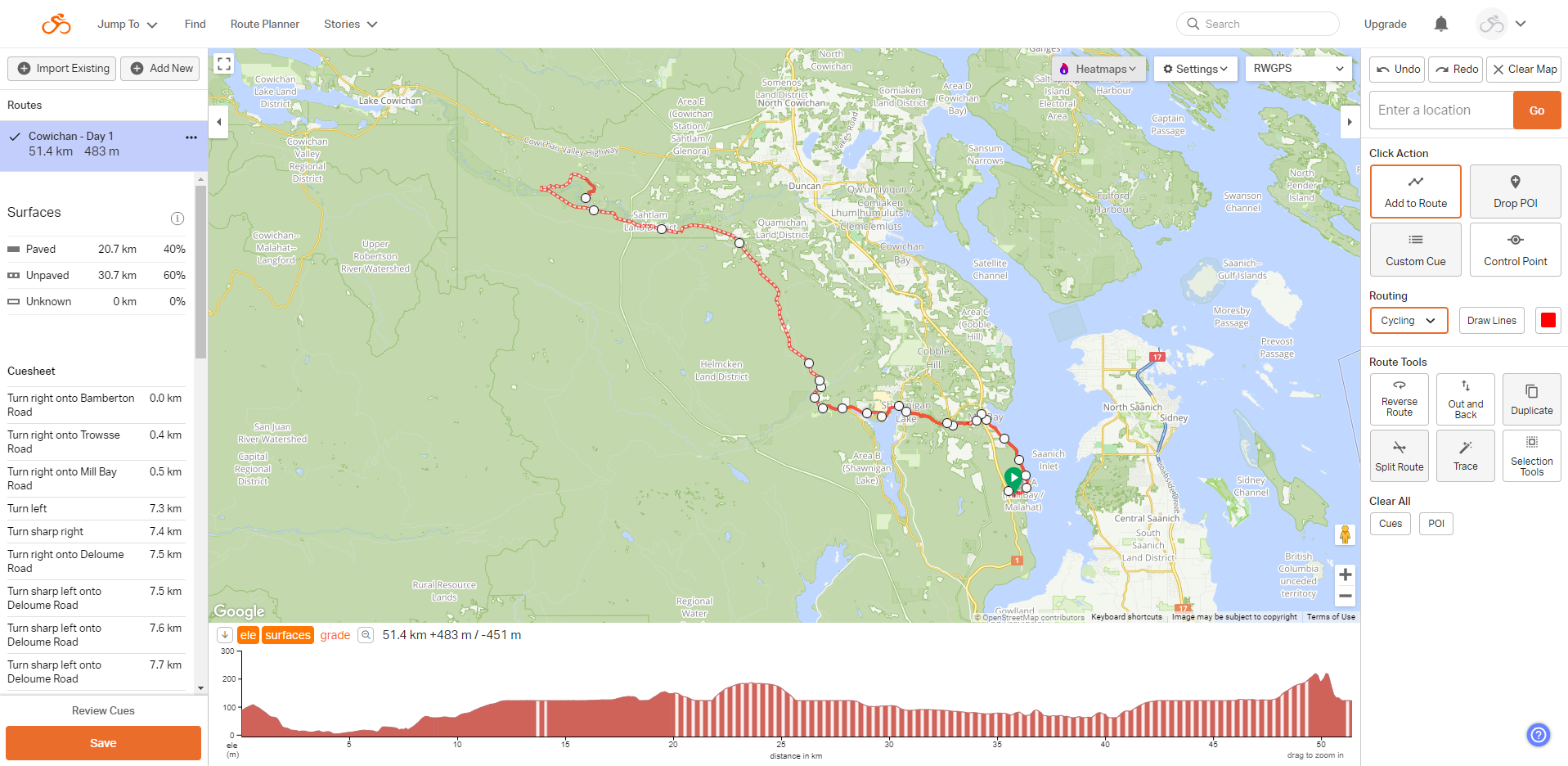
Here is a screen cap of the Ride with GPS route planning tool. This thing is so easy to use, and you can bang out a detailed route in 10 minutes or so. This is Day 1 of a Cowichan Valley trip I was planning last fall before the floods hit. Maybe soon!
GPS Accuracy
This feels like an important topic for a GPS device, but it’s not that simple. I mean, of course you want your device to be as accurate as possible. But how accurate are the trail maps incorporated into the base map? And how accurate was the Ride With GPS map that you used to create your route that you then sent to your device? And then how accurate is your device on top of that? And if the device is telling you that you’re 50 meters from where you know you are, which one is wrong?
So with all of those layers of potential inaccuracy, stacked one upon the other, it’s impossible to say exactly how accurate the Roam is. Overall, I’d say not too bad, but in certain circumstances it can be a bit frustrating.
Most noticeable is the speedometer function, which some of the time appears to me more of a guess than anything. Staring at the speedo while climbing can bring along small bouts of depression, as you swear that you are moving but that little thing on your bars tells you that you aren’t. And then it springs to life and apparently you’re flying along at 30 km/hour. Before you’re not, again. Who needs a speedometer, anyhow?
Next, while you can’t entirely trust the maps that the device is built upon, you’d at least expect for it to follow along with them consistently, but when I followed the same trail back out there were often large gaps between the two tracks this created. Inaccuracy was never egregious. For most situations, anything within a few meters is good enough, but it does lead to some frustration at times, and it makes certain tools (like the speedo) less than useful. As well, forget about tucking this device into your pocket. It needs to be mounted out in the open to work properly. I had some crazy results when I tucked it into my pocket.
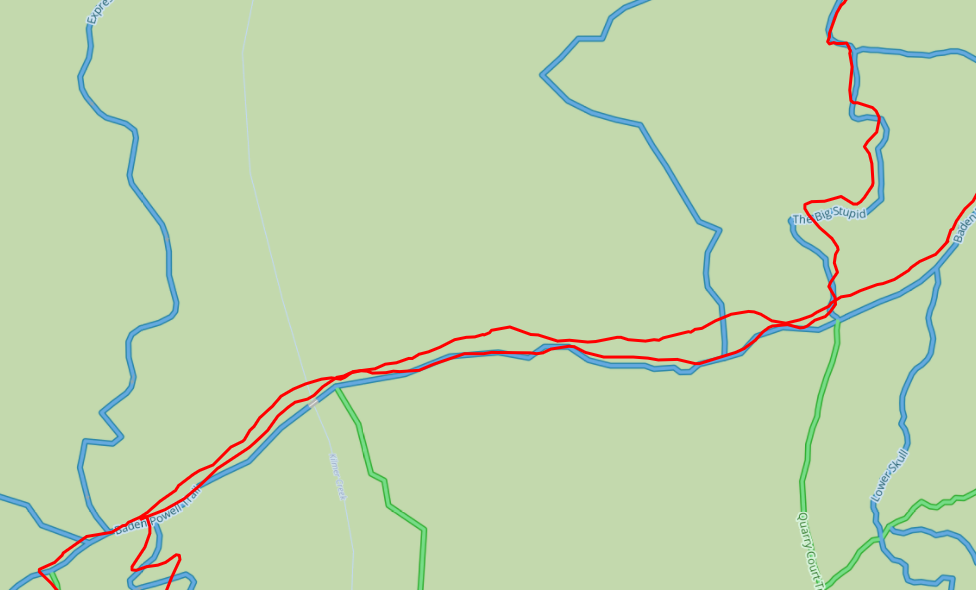
Here is a screen cap of a typical ride. The main track through the middle is out and back on the same trail, and you can see t typical amount of drift between these two tracks. Theoretically, these should directly overlap one another. You can also see that the track doesn't always line up with the trail directly underneath it. How much of that is gps inaccuracy vs. basemap inaccuracy though?
Trip Tracking
We touched on this a bit in the App Connectivity section. For tracking rides and spitting out data, this device (and the 3rd party service necessary to track all of these things) is amazing. It’s so great to just turn the device on at the start of your ride, hit start and then turn it off at the end and then watch everything just magically happen. I really never thought I would care all that much about my ride stats, but as soon as you start seeing e-mails with your segment details rolling in, it’s easy to become addicted.
This has been the biggest revelation for me and has changed the way that I ride, and test. It would honestly bother me a bit if I found myself at the start of a ride without this device. How am I going to know if I beat my time on that one segment?
I’ve also started to do a tonne of back-to-back-to-back rides on the same route, switching out bikes, looking to see where one excels over the other. It’s one thing to think you’re climbing really fast, but it’s quite another to compare directly to the time that you did on another bike the previous day. As I mentioned before, I’ve long had the ability to track where I’m going, but the immediacy and the easy comparisons of Ride With GPS have really changed the way I look at data. Shit…I’m starting to think about things like heart rate monitors and power meters. I’m not ready for Strava though.
Route Following
Overall, following a route on this device is easy. Simply send a route to the device from the App/Website of your choice, find it on the route menu, press start and you’re on your way. Once following a route, the device is easy to follow and gives lots of notice of upcoming forks and tonnes of feedback if you get off track. Loading a route through RideWithGPS would even give me turn-by-turn navigation with trail names! Crazy stuff.
My only challenges came when I would either get off route, or if I was looking to get off route. Once off route, the device does a really great job of telling you that you’ve done so, with lots of flashing and angry beeps. However, if you decide to ignore these warnings and keep pushing forward, it’s not always obvious how to get back on route. This is where device accuracy comes into play. Say you’re off route and you come to an unexpected trailhead. If the GPS thinks you’re 20 m from that trailhead, it doesn’t really give you much information as to where to go. This can also be a bit of a problem if the trail you’re standing in front of is a bit overgrown and the device tells you that you still have 20 m to go. You’re pretty sure that you’re looking at where you need to go, but you’ll convince yourself that you should go and take a look anyhow.
The other challenge with route following is that there often isn’t enough information on the unit to complete the picture. For example, it doesn’t provide you with trail names, so if you want to figure out if that squiggly line that you’re looking at is the trail that you’re looking for (and it’s not on your route), you’ll need a more detailed map to figure that out. Using the device as an actual map isn’t really possible.
This might sound a bit negative, but it is all manageable. Following routes is simple and straight forward. It gives you a lot of feedback, and if you’re off in the boonies without many trail options, it all makes a lot of sense. It’s a great device to use to follow a fixed route, but not so much as a tool if you are looking to randomly explore. Perhaps one shouldn’t expect so much out of such a small device, but poking around in detailed trail maps on your phone is possible with Trailforks, so why not here?
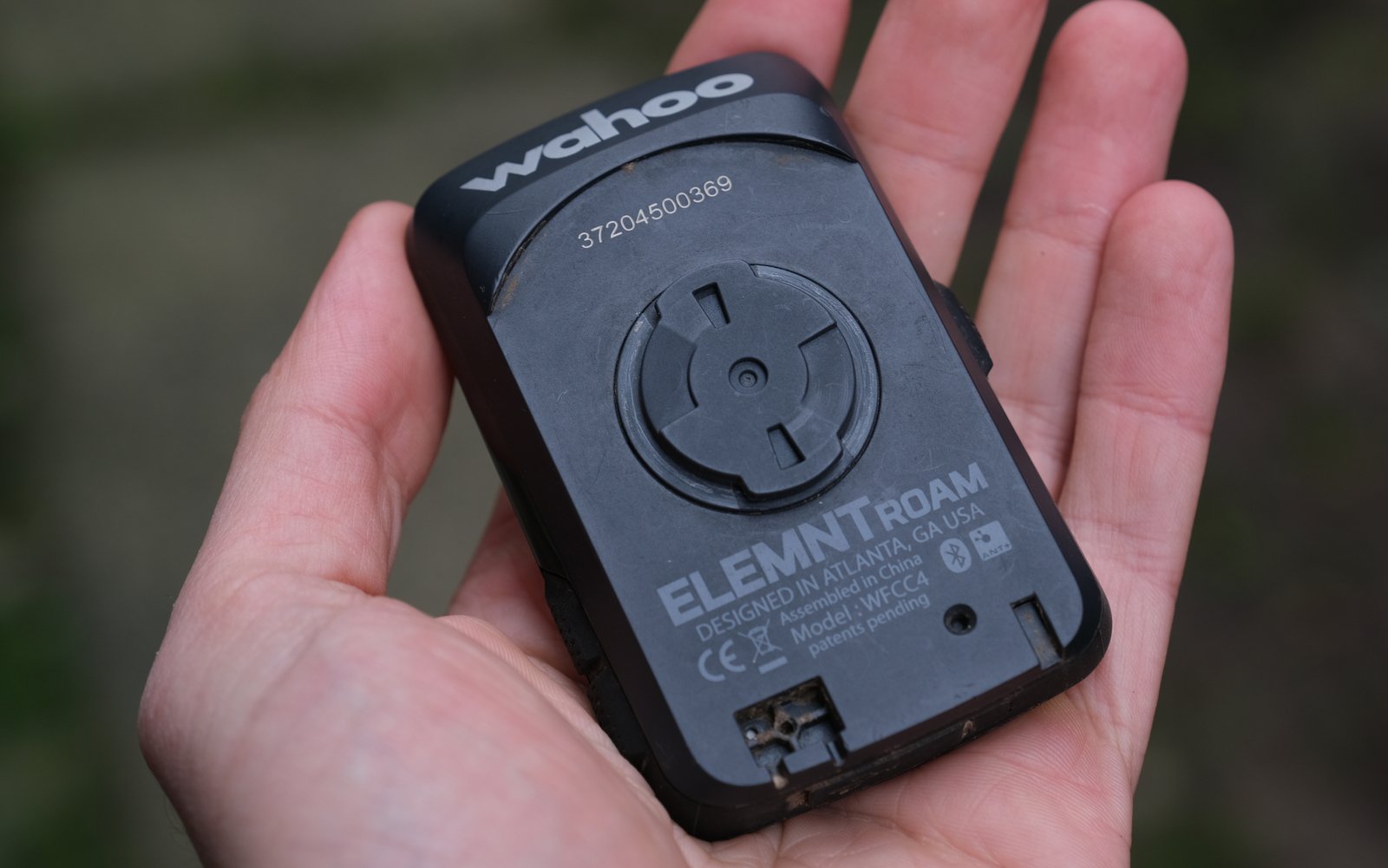
The back of the device, and my hand for scale.
Safety
There is one feature on this device that I think needs to be called out, all on its own. Via the app, you have the ability to send out a tracking link via text message. This gives the ability for people to follow along on your ride and know your location if things go to hell. I found myself using this feature quite often, and I started bringing this unit along whenever I rode or hiked solo, just for that feature. This does require a working/connected phone to function, so it’s not a totally foolproof emergency tool.
Conclusions
My final thought on this device is that I’m really happy that I made the decision to update my ways. This is a great device that is easy to use. Yes, it has limitations that you should be aware of, especially if you’re far from home doing interesting things. For me, it’s now coming along on almost every ride, largely just for the combination of detailed route tracking, ride data (via Ride with GPS) and as a passive safety device. For longer rides, either day long adventures or bikepacking trips, it’s exactly what I need to not get into the situation that I found myself in on the Sunshine Coast. Having a device that I know is not going to die (honestly, the battery seems to last a really long time – I’ve probably only charged it a few times since I’ve gotten it) and that is actively telling me where I need to go is a giant boost of confidence.
The Wahoo Element Roam is available for CAD$549.99 or US$$379.99.


Comments
Justin White
2 years ago
"so I need a 3rd party app to convert it to *.gpx, so I’m always at somebody’s mercy."
Yes, but no. A converter program can be run on your own computer, or even might be open-source, so it can be easily monitored or even cut off from the 'net completely if you really want to make sure no one is watching.
Don't get me wrong, my Garmin watch auto-syncs (over wifi no less, doesn't actually need the app once set up) with Garmin Connect and Strava and my own cloud storage, so I'm down with how easy it can be, but there still are fairly simple options for those who want to track rides but don't want to give away their data.
Good stuff!
Reply
Dave Tolnai
2 years ago
This is a fair point.
Reply
Velocipedestrian
2 years ago
Nice write up Dave, but I'm not convinced yet.
Used Strava for a couple of years, then realised that a good (feeling) ride would sour as soon as I saw I'd been going slower than average. Uninstall.
Started using Glympse to send a GPS tracking txt for solo rides, then looked at the track on the map and saw how inaccurate it was. Uninstall.
Currently using the 'text a friend who's in an office' method of safety, combined with the alternative GPS - Guessing Position of Self.
Reply
Dave Tolnai
2 years ago
I have been feeling like this constant measuring of self might not be entirely positive. For now, in the interest of “testing accuracy”, I’m going to keep doing it. But advice noted.
For safety, I think there’s value in quickly and easily sharing your position on a trail within 5-10 meters. Text a friend doesn’t work as well if you change your plans halfway through the ride, or are unconscious.
Reply
shenzhe
2 years ago
I have found that constantly measuring myself hasn't been too much of a problem for me. Constantly competing isn't always positive though. Be that competition with self, or with others. I have a Garmin computer and before that I did Strava on my phone. I make sure to use my Garmin/Strava for tracking so that my wife knows where I am. This helps save me from the "Where are you at? / Are you dead?" texts (are you dead typically messaged jokingly).
My wife has a different relationship with competition than I and if there is someone/thing to compete with she must compete and she must be the best, and if she isn't the best it's a failure that must be remedied, health and happiness be damned. So, while I appreciate the safety aspect of a device like this, I know that it might ruin some peoples' experiences. I'm just happy that I can log my rides look back fondly at them and not worry that I wasn't the fastest (I'm never the fastest, and these days it's a flip of the coin if I'm even faster than half my previous rides).
Reply
Justin White
2 years ago
Just remember you don't need to actually look at the numbers on Strava or whatever. I've tracked almost every ride I've been on for like 10 years (originally just raw gps tracks from an old now-discontinued app, now Strava and Garmin from dedicated GPS devices, and sometimes raw tracks from OSMAnd (better maps, good for new-to-me spots)). But I've literally never let those numbers make me feel bad about a ride. They're just a reference to remember where I've been and who I was with.
If just seeing some numbers can ruin a ride, I think you have bigger problems than which device or app to use.
Reply
Pete Roggeman
2 years ago
Exactly the same relationship I have with Strava. I don't ever worry about times, just distances and climbing totals for reference, and routes for future.
Reply
AndrewR
2 years ago
RoadID app has an emergency feature that is very good and does not need to be linked to any mapping/ gps app. It also has a very noticeable 'alert' siren that sounds before it sends the 'help me' message.
Reply
Sethimus
2 years ago
rides under trees and complains that the device is neither accurate nor able calculating the speed correctly. oh the irony.
(your speedometer problem can be fixed by using a proper sensor for that on your wheel)
Reply
Dave Tolnai
2 years ago
Well...one of the purposes of the device is provide such data without the need for a wheel sensor, so mentioning how well that worked felt like a reasonable thing to include. I recognize the limitations of gps in the forest, but those also turn into limitations for this device in the forest. Personally, it worked for me, but others might have different expectations.
Reply
Sethsg
2 years ago
A bike computer seems like a pretty cool tool. Especially the Garmin ones that can tell you things like jump hang-time and distance.
The best thing for navigation in my opinion is a physical map and a compass you never need to recharge either and you can't really break them if you crash.
Most paper (plastic) maps are waterproof, they also cover a good-sized area, and the one I have seems to have all the MTB trails that Trailforks has in my area. Plus they only cost like $15. It is also a pretty cool skill knowing how to use one that very few people have.
Reply
Niels van Kampenhout
2 years ago
I like paper maps as well but here in BC trail networks tend to change a lot so maps become outdated very quickly.
I've had good success with printing out my own maps from the Trailforks website before riding in unfamiliar areas. I usually annotate them with pencil and yellow marker for my intended route and put them in a plastic ziplock bag for waterproofing. Lo-tech solution for sure but much easier and faster than taking my phone out all the time and much cheaper than buying another GPS device.
Reply
LWK
2 years ago
I'm learning my way around my new Garmin 530. The stupid thing beeps and alerts every time the wheels leave the ground for a split second - even very small bunnyhops. I'm finding that amusing and annoying!
@Niels, how do you find using paper maps in ziplock bags better than a phone? especially if you're in a new (to you) area with lots of trail junctions and need to be constantly checking? honestly curious as I've wondered if there is a good way to get away from Trailforks phone app. Maybe inputting some waypoints into my Garmin combined with a paper map for reference might work.
Reply
Niels van Kampenhout
2 years ago
The paper map simply gets folded and goes into my shorts pocket so I can grab it really easily to have a quick look. With a little pre-ride map study and reasonable spatial awareness and map reading skills that quick look is often enough. Works with long fingered gloves, doesn't need to be unlocked, no need to zoom in or out, no need to protect it from a crash, etc.
Of course it depends a lot on the terrain and signage (if any) how easy or hard navigation is and it's still nice to have a phone stuffed in my pack as backup to confirm location using GPS if it isn't directly obvious from the paper map.
Reply
Andeh
2 years ago
I've been using mini-GPS computers for the last couple years, and currently have the Roam v2. The v2 is basically the same as the v1, but with a color screen and slightly smaller form factor while maintaining the same screen size. It's small enough that you can use it with a K-Edge stem spacer mount without blocking a steerer tube mounted OneUp EDC. It charges via USB-C.
A few other nice things about using a mini computer like this that weren't mentioned in the article:
* if you're running it in the backcountry as a map, you can keep your phone shut off or in airplane mode, preserving your phone's batteries for emergencies. (You can pre-cache a map before leaving home.)
* you can see text message previews on the screen. Nice for knowing when your late buddy finally arrived, or when your wife is wondering when the hell you're coming home to take over watching the kid.
* you can go full nerd mode and see what gear your AXS is in, or your current heart rate if you're someone with a medical condition
Also, it doesn't matter if the location tracking isn't super accurate in terms of emergencies, as long as they can tell what trail you're on and rough location. I know a guy who knocked himself out a few years back but thankfully was running Strava Beacon. His wife noticed he was a half hour late and hadn't moved in an hour, so she called one of his friends who knew the trails. They hiked up and found him with a bad concussion.
Reply
Sethimus
2 years ago
there is only one roam but 2 bolts. bolt 2 is most likely the one you have…
Reply
Andrew Collins
2 years ago
PSA: if you're a gumby like me who often stacks, mount the computer on your top tube. It means that your top cap will crack your sternum instead of your computer. This in turn saves the computer.
I'm not sure if Wahoo offers the option, but Garmin offers to use the glonass and Galileo as well as the traditional GPS systems. Turning all this on uses more battery but it is more accurate.
Reply
cxfahrer
2 years ago
All this doesn't convince me of ever using such a device.
What is it good for, if one has to use some kind of other app/map anyway? I never follow gpx routes exactly , even if I myself created them - the reality has so much to explore. Trails can start 20m from where they started last year.
I use Strava for tracking (never mind, there are no secrets any more over here), I set my own segments and ignore results on other people's segments. Useful to watch my degrading over the last years.
Strava is great to download free gpx tracks (in the free version, if people do allow their tracks to be downloaded) of trails or routes from riders I follow that know their hometrails well (e.g. Nina H.) or whom I trust that they do not ride the boring stuff. This saves a lot of time planning and wondering when on the track why the hell one would ride there.
Trailforks is really bad (free version) as it always needs internet. I rely on Oruxmaps with openstreetmaps on the phone, but yes, the battery and that phone beeping and shouting in my pocket is not the best way.
Oruxmaps has this security feature too, sends a SMS or mail to someone with your position.
Reply
Justin White
2 years ago
Pretty sure even Trailforks Free can download maps for offline use.
Why is your phone shouting and beeping in your pocket with that app? Sounds like a crappy app if it can't be run silently.
Reply
cxfahrer
2 years ago
If I want it to shout at me to stay on track.
I switch that off most times because it isn't helpful, so that's a point towards the Garmin/Wahoo. Phone on handlebar does not really work (display etc).
Reply
Dave Tolnai
2 years ago
Fair. And if you do have a system that works for you, why on earth would you spend money on yet another device? There are a number of different ways that you can do similar things, and ever person's needs are different. For me, this came about because the two devices that I had (phone and old school GPS) didn't work all that well any longer for what I was trying to do. This solves a couple of my problems due to having a really great battery life, and by sitting there right in front of me on my handlebars. How easily it handles data opened up a few new things for me, as well.
Reply
LWK
2 years ago
What was the source of your frustration with Trailforks? I've been to some fairly remote locations and never had a problem locating myself on the marked trails - or are you using it for navigation on roads/paths that are not actually marked as trails in Trailforks?
Reply
Dave Tolnai
2 years ago
I don't want to bag on Trailforks because I think it's a great tool. For my specific complaint referenced, I think my biggest problem is that Trailforks doesn't do a great job of giving the context of the whole system, especially with logging roads and whatnot. If you look at the Sunshine Coast in particular, it shows all of the bike trails, but they don't really show the underlying network of roads all that well. So if you're trying to navigate between systems, it's not the best.
Reply
Mark
2 years ago
Hey Dave, what model is your old Garmin? For the price of the Wahoo do you think a newer Garmin at the same price point would offer better all-around performance?
Reply
Dave Tolnai
2 years ago
GPS Map 60CSX.
That's an interesting question. I haven't looked at any new Garmins so it's tough for me to speculate on how they work. The Wahoo is just so easy to use. I'm sure Garmin has worked in a lot of the same features. It really depends on what you want to do. If you want a multi-use device with better mapping capabilities - the ability to upload different basemaps for example, then yes, it's probably worth exploring something like that. If you're 90% or more cycling, a device like this becomes more appealing. But I don't really know enough about the new devices to comment.
I would say the biggest benefit of the Wahoo is that there's a spot on my bike that it clips to and I don't have to worry about hauling a bag or jamming a largish GPS device into a pocket. But then again, the Wahoo doesn't work all that well if it's not out in the open on the bike.
It would also be interesting to compare the in-the-trees accuracy of a dedicated GPS device vs. a cycling computer. There's probably some accuracy to be gained from a larger device with an antennae sticking out the top.
Reply
Mark
2 years ago
A-ha! I have the same one (60CSX) and it's worked fairly well. I've read the reception/tracking abilities of the newer models are much better. I think a huge advantage for the Garmins is that they take AA batteries, so it's easy to pack along an extra set or two for longer duration rides/trips where recharging a device with a built in battery may not be an option. There's also a decent handlebar mount for the Garmin's too. Maybe you can get ahold of a new Garmin that sells at the same price point to do a comparison test?
Reply
Hayes Kenny
2 years ago
I use that same K-Edge top cap mount for my Wahoo as well. I drilled a hole through the blue plastic part so you can stick your allen key right through to swap between bikes and it makes getting it lined up a lot easier.
I don't know why they didn't design it like that in the first place, but it's a quick fix with a power drill!
Reply
Dave Tolnai
2 years ago
That's a great idea. I thought about it, but figured I'd just crack the plastic piece. Good to know it's possible.
And you're right, they should build it like that.
Reply
Sebov
2 years ago
I am having the same combo. K Edge makes me go crazy. Never really right angled. Roam: Okay. But not being able to move the map - just zoom in and out - makes me go crazy as well. Can‘t really make on the fly plans/detours if a road is closed eg for forest works… had a Garmin 64 before: good map moving, bad connectivity, expensive maps, strange openMTB Maps.
So I gave the Wahoo a go. Having a Levo SL for the Kids Trailer and Commuting: can display Hear Rate, Motor Mode, Battery - but I rarely use it.
Most of the times I know the most parts of my route and try sth new with OutDoorWorks on my Apple Watch: best Open Street Maps. Better than everything. Enough for finding my way.
For epic multi day adventures in the Alps none of my devices is perfect - especially the lacking ability of moving the map on the Wahoo is a mess.
Reply
Please log in to leave a comment.