Jerry in the Chilcotins
After seeing all the great articles Lee Lau has put together about the Southern Chilcotins, how could you not want to venture there if you are a true mountain biker? I’ve been wanting to ride the area for years but I never made the journey until this past weekend. I’m not sure why I haven’t gone before but it was probably due to not having a bike under 35 lbs, or perhaps the call of air miles on Aline or the root ball reggae of Garbanzo. This year I made it a personal goal to ride the “epicness” that this mountain range delivers and I am lucky enough to be riding a 2011 Specialized Stumpjumper 29er (Thanks Jason C). This is my first XC’ish bike in over 10 years and the big wheels make it a perfect weapon to hump over the many rock and streams this terrain continually dishes out. For more on my 29er click here.

Last fall Fred Z made all the arrangements for a Lorna Lake float plane drop for August 27th-28th weekend but I had to bail earlier in the year due to wedding photography gig for that weekend (shameless plug: jerrywillows.ca). One of my other buddies Mark made arrangements for a short camping trip at Tyax for August 13th-14th weekend so I was back on. Stoked!
The week before the trip I was like a kid before Christmas. I’ve never been so excited to go on a bike trip. I couldn’t stop looking at Lee Lau’s previous tracks on Google Earth as they twist and turn throughout the mountain ranges. Zooming in and out, rotating around the mountain tops, pretending like I was in a helicopter hour after hour. Viewing all of Lee and Pat Mulrooneys’ images and words got me more excited as the hours ticked by.

Friday finally rolled around and we left North Vancouver at around 5:30 pm. Traffic was good and we hit Pemberton before 7:30 pm. No road trip is complete without dinner at The Pony in Pemby. It was by far the best food I’ve had in a long time. The meat loaf was so good I had it again on Sunday night along with everyone else.
After dinner we put $100 bucks in just to get the tank topped up (reference for Rusty) and grabbed some beverages, bound for Tyax via the “Hurley 500”. I’m sure Semenuk practices his rally racing with his WRX on this so called road. It was dark, we were doing 4 wheel drifts in the F150 around the rocky chundered corners as we climbed and continually climbed (a sign of things to come) hoping we wouldn’t get a flat. With no flats we made it to camp in record time. We set up the tents, downed a swig or two of gin and it was lights out. Epicness awaited.

DAY 1
All week I wanted to do an epic the first day and then do a chill ride the second day. Little did I know there is no such thing as chill day up there unless you do the local trails by the Tyax Lodge itself. We had an initial plan of riding Taylor –> Windy Pass –> Spruce Lake –> Deer Pass –> Gun Creek. This was quickly shot down as it would have been a 12 hr day. Graeme, another riding bro on the trip had alternate route lined up straight from Lee Lau himself. As we discovered, Lee does not like to take the easy route. He’s a mad man and should be locked up. We were cursing him many times during this trip.

The problem with camping is everything takes so long. We were up before 7am and we started riding around 9 am. My pack was heavy, real heavy. With the camera, GPS, extra batteries, clothes, spare parts, water it must have weighed 15 lbs or more.
It’s about a 10 km journey on double track to Taylor Cabin and around 2,000ft vertical of climbing. It takes an hour at a hurried pace.


Our next step on the journey was to Camel Pass. This is where it starts to get steep and hike a bike sections begin.


The best part of about riding up is the riding down. We headed down from Camel Pass to sub-alpine forest to High Trail.


The main descent from the LS Bluff Trail to High Trail was sandy and had tight switchbacks. Not that rewarding for what you had to do to get there.
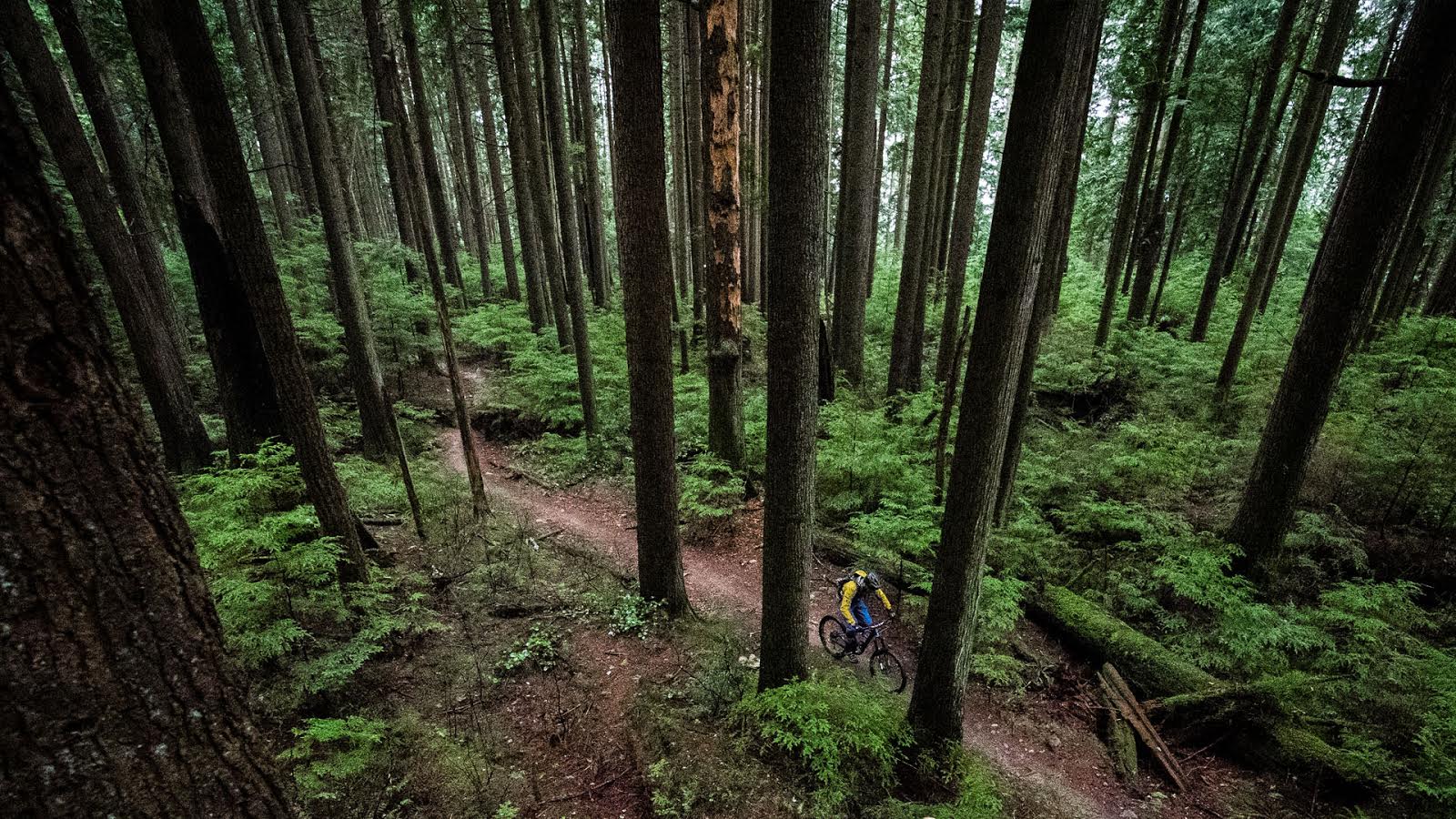
From High Trail to Lick, it was up and down singletrack. We were all absolutely punched by this time but somehow we managed to keep going. I did go over the bars on High Trail; one thing you have to watch out for are “pokers” on the side of the trail. Whoever maintains the trails does not cut the small trees down to the ground so you have to be really aware of not snagging a crank. I went down hard and fast but fortunately my bike and I were fine. To get to the top of Lick involved more pushing. I was sure hoping the downhill was going to be worth it.

I didn’t take any more photos at this point as I was totally punched and was hating life. We were about 9 hrs into our journey so far, light was fading and were hoping to make it back before dark.
I am happy to report the Lick descent kicked ass. I describe it as fast, flowy and loose baby! Finally some sweet single track and in the trees. You do have to watch out for logs (fall down) as the trail maintainers don’t cut much wider than the trail which could get you in heaps of trouble if your not on your game. The trail seemed like it would never end… it was a lot of fun and not once did I notice the lactic acid burning in my quads from the hike up. I felt revived, fresh and so happy to be descending. Huge smile following Fred on the way down.
We finally rolled into camp around 7pm. I was so exhausted and my legs were on absolute fire. Everyone felt the same way. No way we could ride tomorrow, absolutely not. I would have laughed out loud if someone mentioned it. I was thinking of drinking beer and sitting on the dock all day trying to recover. This was the toughest day I’ve ever had on a bike by a long shot and I am not sure how I made it through sometimes.
Liz and Mark cooked up a great pot of pasta for everyone. Only 1 beer for me. I just wanted to go to bed. Lights out !
So here’s the tally for the day:
Total Ascent: 8,400 ft
Total Distance: 48 km
Highest Elevation Point: 7,800 ft
GPS route/map is at the bottom of the article
No mechanicals, injuries or flats !
Stay tuned for Part II. Have you ridden in the Southern Chilcotins yet? Spill here…


Comments
Please log in to leave a comment.